 Geobru catalogue
dataset
Type of resources
Available actions
Topics
INSPIRE themes
Keywords
Contact for the resource
Provided by
Years
Formats
Representation types
Update frequencies
status
Scale
Resolution
-
This dataset corresponds to the vegetation cover in the Brussels Capital Region. It is made of two raster images : vegetation 2021, and vegetation 2023.
-
This dataset corresponds to the total occupancy rate of parking demand in 2014 by the different modes of transport (cars and vans, motorised two-wheelers, lorries, other) on all the roads in the Brussels-Capital Region.
-
The register contains information on releases of pollutants to air, water and land, as well as off-site transfers of pollutants in wastewater and waste in the Brussels region. It covers 91 pollutants, including greenhouse gases, other gases, heavy metals, pesticides, chlorinated organic substances, other organic substances and inorganic substances. It complies with the Regulation 166/2006 of the European Parliament and of the Council of 18 January 2006 concerning the establishment of a European Pollutant Release and Transfer Register
-

Brussels-Capital Region : This map shows the Health Impact Screening score for air quality (0-8) in the Brussels Capital Region. It was produced as part of the 2020 study on the "Impact of 'Nature-Based Solutions' (NBS) on urban residents' exposure to air pollution, noise pollution or high temperatures - Overview of general knowledge and recommendations for the Brussels-Capital Region". This map is based on the 2018 annual average nitrogen dioxide concentration map. For the methodology used, see p.49. The study report (in dutch) is available at http://document.environnement.brussels/opac_css/elecfile/NatureBasedSolutions
-
The UrbIS - Mapping M7 to M8 product corresponds to the mapping between identifiers of some M7 objects and their equivalents in M8 when the identifiers are not identical. The mapping is performed as follows: ADPT in M7 corresponds to Addresses in the M8 Parcels and Buildings product; 3D BU in M7 corresponds to Three-dimensional buildings in the M8 3D Constructions product; and 2D BU in M7 corresponds to Buildings in the M8 Parcels and Buildings product. The dataset is freely downloadable as three csv files.
-
This dataset corresponds to the greenway. It is made of one geometric classe : the greenway.
-
This dataset includes the urban planning infractions observed on the territory of the city of Brussels as specified in article 300 of the Code bruxellois de l'aménagement du territoire / Brusselse wetboek van Ruimetelijke ordening.
-
This dataset corresponds to the nitrate-vulnerable zone in accordance with the prescriptions of the European Directive 91/676/EEC, by the Ministerial Order of 25 May 1999. It is made of one geometric classe : the nitrate-vulnerable zone.
-
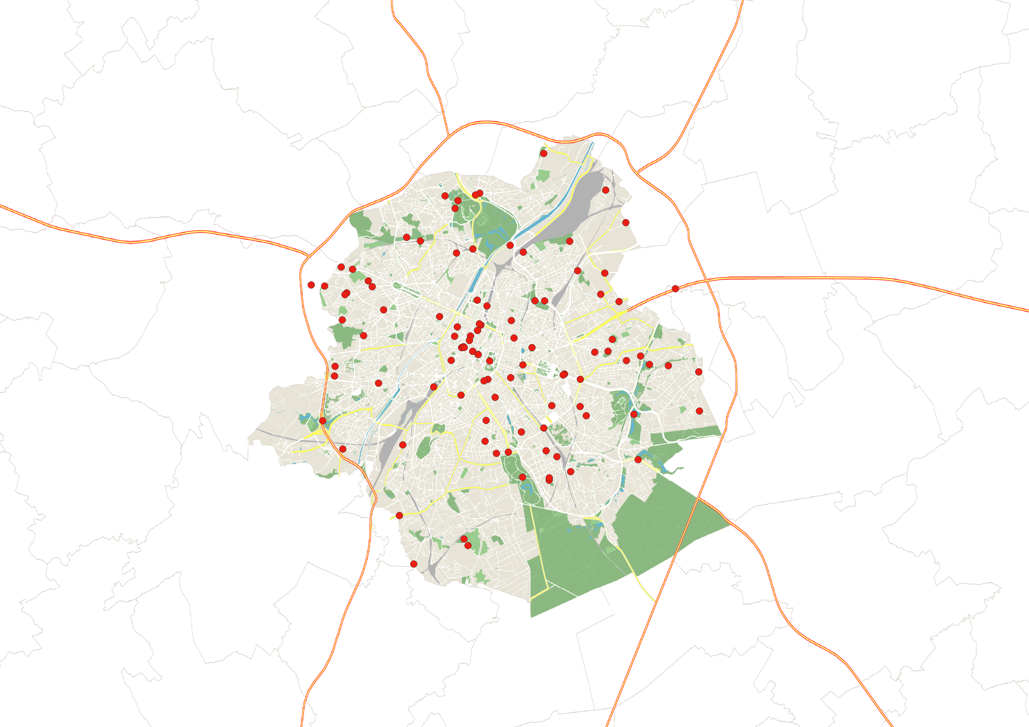
This dataset is an inventory of toilets accessible to the public in the Brussels-Capital Region in 2023. It includes information on the price and number of toilets available, their opening hours, access for people with reduced mobility, and whether a sink and changing table are available. It is freely available to download as an Excel file.
-
This dataset brings together air quality measurements from the Brussels telemetry network. It includes data on concentrations of the main atmospheric pollutants recorded at stations in the Brussels-Capital Region telemetric network, enabling compliance with air quality standards to be assessed and changes in pollutant concentrations to be monitored.