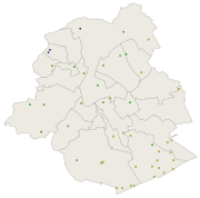
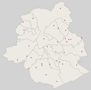
 Geobru catalogue
500
Type of resources
Available actions
Topics
INSPIRE themes
Keywords
Contact for the resource
Provided by
Years
Formats
Representation types
Update frequencies
status
Scale
-
Brussels-Capital Region : data on the 5 Groundwaterbody of the Area of Brussels, defined under the Directive and the Ordinance Water : code European, code of Brussels and name of the water mass, hydrographic district
-
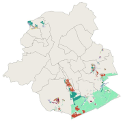
Brussels-Capital Region : location of the different surface water quality monitoring sites under the Water Framework Ordonnance and Directive. Surface waters concerned are surface water bodies: Canal, Senne and Woluwe. Monitoring involves a series of chemical, physico-chemical parameters... The code and the name of the monitoring site are given.
-
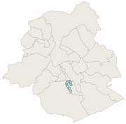
This dataset corresponds to drinking water supply zones in the Brussels-Capital Region from 2020 to 2024, in accordance with Directive 2020/2184 on the quality of water intended for human consumption. It is made up of one geometric class: drinking water supply zones.
-
Brussels-Capital Region : location of Brussels drinking water catchment drainage gallery operated by VIVAQUA. Each section of the drainage gallery is named. Classified as protection area 1 of water extraction (with the extraction wells).
-
This dataset corresponds to the index of soil quality in Brussels (ISQB). It is made up of three classes : the index of soil quality calculated per cadastral parcel as part of the IQSB Pro studies, the index of soil qualitycalculated per cadastral parcel by Brussels Environment and the index of soil quality calculated per sample by Brussels Environment.
-
Brussels-Capital Region : location of the different groundwater level monitoring sites (or piezometric sites) managed by Brussels Environment under the surveillance monitoring of the groundwater status in accordance with the Ordonnance and the Water Framework Directive. Indication of the analyzed water body, the European Code and the Brussels code of the monitoring site.
-
Brussels-Capital Region : location of the different groundwater quality monitoring sites managed by Brussels Environment and which results are transmitted through the reporting to Europe (under Article 8 of the Water Framework Directive). Indication of the analyzed water body, the European Code and the Brussels code of the monitoring site. Distinction between two types of monitoring: surveillance monitoring for all groundwater bodies (type_monitoring = 1) and operational monitoring for groundwater bodies identified as being at risk of failing to achieve the objectives of good status (type_monitoring = 2)
-
This dataset corresponds to the protected sites and natural habitats, in accordance with the ordinance of 1 March 2012 on nature conservation in the Brussels-Capital Region. It is made of six geometric classes : the protected areas in the Sonian Forest, the nature and forest reserves, Natura 2000 sites, the impact zone around Natura 2000 sites,
-
Brussels-Capital Region: localization of the extraction wells for drinking water in Brussels, run by VIVAQUA. Ranked as protected area 1 of the water extractions (with the drainage gallery)
-
This dataset corresponds to the sensitivity classes applicable to the soil condition inventory, defined according to the Regional Land Use Plan (2017) and according to the correspondence established in the decree of 29 March 2018 determining intervention standards and sanitation standards. Soil pollution response standards are derived from this. The sensitivity class is to be adapted to 'special area' if the site under study is in a Natura 2000 area or in a drinking water catchment protection area. The dataset specifies whether the site is yes (t=true) or no (f=false) in such an area. There are 6 different sensitivity classes: (1) residential, (2) particular, (3) industrial, (4) ZFM and ZEMU, (5) ZIR, ZIRAD and RF, (6) other.