From 1 - 10 / 79
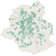
  • Brussels-Capital Region: location of the buildings winning the "Exemplary Buildings" calls for proposals organised with the aim of encouraging initiatives in eco-construction and integrated renovation. In order to be selected, winners must fulfil a series of criteria with regard to energy and management of water and waste, but also comfort and aesthetics, all while remaining financially accessible for the Brussels market. The dataset contains the number and name of the projects, and a link to an description factsheet.

  • Brussels-Capital Region : In order to help the inhabitants of Brussels to raise fruits and vegetables, the institution 'Bruxelles Environnement - Brussel Leefmilieu' set up since 2011, the kitchen garden's network. Professionals coordinate the network with over 80 members. Together they share their passion and know-how on kitchen gardens.

  • Brussels-Capital Region : location of a buffer zone of 2km around the groundwater catchment site protection area 3 in the Brussels-Capital Region.

  • Brussels-Capital Region: location of the three areas of limitation of aircraft noise defined by the order of the Government of the Brussels-Capital Region of 27 May 1999 on the fight against the noise generated by air traffic. Note : http://geoportal.ibgebim.be/pdf/metadata_doc/19990527_agb_LutteBruit_TraficAerien.pdf

  • Brussels-Capital Region : this directive has as an aim the prevention of the major accidents implying of dangerous substances and the limitation of their consequences for the man and the environment, in order to ensure in a coherent and effective way in all the country of the high levels of protection. The geographical data file SEVESO consists of several classes of objects which make it possible to locate all the SEVESO sites on the territory of the area of Brussels.

  • Brussels-Capital Region : This flood hazard map identifies areas where flooding could occur due to stream overflow, runoff from rainwater, overflowing sewers or a temporary rise in the water table, even in places where no flooding has been observed until now. The absence of a flood hazard zone on the map does not guarantee that flooding will never occur as it does not take into account certain causes of flooding such as a local failure of the sewage network, etc. Please note that these maps have no regulatory value, they have been produced in accordance with the European Directive 2007/60/EC to determine the prevention and protection measures. The maximum scale is 1/10.000 as the modelled data are not representative on a larger scale.

  • Brussels-Capital Region: extent of sub-drainage-basin (or sub-catchment area) of the rivers in the Brussels Region and surrounding area

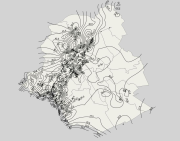
  • Brussels-Capital Region: elevation of the tops of the Stratigraphic Units of the Brussels-Capital Region (SU/BCR), excluding quaternary units. Elevations (m-DNG/TAW) are represented by contour lines spaced with a 2.5m pitch. Data is limited to the Brussels-Capital Region’s border extended with a 500 m buffer zone. These elevations were extracted from the BruStrati3D v1.1 geological model. This data is generated from models and may contain errors, inaccuracies and gaps. It has informative value and may under no circumstances replace a study carried out by an expert. Bruxelles Environnement cannot be held liable for the consequences of the use of this information.

  • Brussels-Capital Region: Sensitivity classes applicable to the soil state registry, defined according to the regional land use plan (2017) and according to the correspondence established in the decree of 29 March 2018. Soil pollution response standards are derived from this. The sensitivity class is to be adapted to 'special area' if the site under study is in a Natura 2000 area or in a drinking water catchment protection area. The dataset specifies whether the site is yes (t=true) or no (f=false) in such an area. There are 6 different sensitivity classes: (1) residential, (2) particular, (3) industrial, (4) ZFM and ZEMU, (5) ZIR, ZIRAD and RF, (6) other.

  • Brussels-Capital Region : Areas intended for the conservation and the regeneration of a natural environment that is of high biological value as it shelters rare animal and vegetable species or boasts considerable biological diversity