 Geobru catalogue
daily
Type of resources
Available actions
Topics
INSPIRE themes
Keywords
Contact for the resource
Provided by
Years
Formats
Representation types
Update frequencies
status
Scale
-
This dataset corresponds to applications for environmental permits filed in the Brussels-Capital Region, as defined in Title II of the ordonnance of 5 June 1997 regarding environmental permits. It includes a single class covering environmental permits that have been granted, refused, as well as those still under review. The data are accessible via WFS or through full download.
-
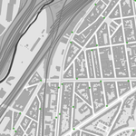
Les dropzones sont des périmètres où il est permis de stationner les véhicules des services de cyclopartage en flotte libre ; à savoir les vélos, trottinettes et scooters partagés en flotte libre. Les dropzones sont marquées et matérialisées dans l’espace public afin d’informer et sensibiliser les usagers sur l’obligation d’y stationner leur véhicule partagé. Les données sont gérées par la Région pour les dropzones situées sur les voiries régionales et par les 19 communes pour les dropzones situées sur les voiries communales. Les données sont accessibles et utilisées par les opérateurs de cyclopartage en flotte libre par le biais d’une plateforme collaborative ; une mise à jour des données est réalisée quotidiennement sur la plateforme afin d’assurer une meilleure synchronisation avec les plateformes et les interfaces des opérateurs.
-
This dataset corresponds to applications for urban planning permits filed in the Brussels-Capital Region, as defined in Article 98 of the Brussels Town Planning Code. It includes both municipal and regional permit applications. The data is updated four times a day via the WFS and once a week, on Monday morning, via full download.
-
This dataset corresponds to analyses and suspicion of contamination of water and soil in the Brussels-Capital Region. It is made up of two objects: cadastral parcels presenting a risk of pollution by PFAS and the results of analysis campaigns by borehole
-
This dataset corresponds to soil condition inventory in the Brussels-Capital Region. It is made up of one geometric classe : cadastral parcels categorised according to a presumption of pollution and any studies and work to treat soil pollution
-
This dataset corresponds to the cadastral parcels reworked to match the soil condition inventory
-
This dataset corresponds to the index of soil quality in Brussels (ISQB). It is made up of three classes : the index of soil quality calculated per cadastral parcel as part of the IQSB Pro studies, the index of soil qualitycalculated per cadastral parcel by Brussels Environment and the index of soil quality calculated per sample by Brussels Environment.