 Geobru catalogue
irregular
Type of resources
Available actions
Topics
INSPIRE themes
Keywords
Contact for the resource
Provided by
Years
Formats
Representation types
Update frequencies
status
Scale
Resolution
-
These various map layers are essential for the effective management of cultural heritage (real estate) in the Brussels-Capital region. They enable authorities and stakeholders to monitor, protect, and promote this valuable cultural legacy. Protected Properties: This map layer displays the locations of cultural properties that are officially protected by the relevant authorities. Protection Zones: This map layer shows the designated protection zones around the protected properties.
-
This layer shows the locations of monuments, ensembles, trees, and sites listed in legal inventories.
-
These map layers include the perimeters of programs and urban renewal operations financed by the Brussels-Capital Region (sustainable neighborhood contracts, urban renewal contracts) as well as the current preemption perimeters.
-
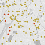
Ce dataset contient tous l’inventaire des accidents impliquant au moins 1 piéton blessé sur ou à proximité directe d'une traversée piétonne (moins de 10m) entre janvier 2019 et septembre 2023 inclus. La géolocalisation a été fait sur base de la description de la localisation dans le pv. La précision géométrique n’est donc pas élevée. Les données reprennent la date de l’accident et des informations sur la gravité de l’accident (tué, blessé grave ou léger).
-

Les zones accidentogènes (ZACA) ont été identifiées sur la base de la localisation des accidents de la route avec blessés et/ou morts survenus en 2022-2023. Un algorithme de regroupement (clustering) spécifiquement paramétré a été appliqué aux coordonnées géographiques des accidents, puis un seuil de 10 accidents sur une période de 2 ans a été retenu. L’exécution de cette procédure a conduit, en 2024, à l’identification de 89 zones accidentogènes (ZACA) sur les routes régionales et communales.
-

The product Airborne LiDAR (Light Detection and Ranging) pountcloud provides a three-dimensional vector model covering the Brussels-Capital region. This is the product of several LiDAR data collection campaigns captured from the air. The data is available in open data, via a visualization tool and direct download as a Las file.
-
The Digital terrain model product is a raster image composed of pixels whose value corresponds to altitude. The dataset is freely downloadable as a zipped file.
-

This dataset includes the RGB & NI (Red, Green, Blue and Near-Infrared) orthophotos created in 2022. The images cover the entire Brussels Capital Region, with a resolution of 5 centimeters. The dataset is freely downloadable as a zipped file.
-
The UrbIS - Digital surface model product is a raster image capturing all the objects (natural or built) on the surface of the ground. The dataset is freely downloadable as a zipped file.
-
This layer includes the collective opinions issued by the Royal Commission of Monuments and Sites on both protection proposals and requests for work on buildings or sites, whether or not they are protected. The description of each specific procedure, during which the RCMS provides its opinion, is available on its website: https://crms.brussels/procedures.