 Geobru catalogue
location
Type of resources
Available actions
Topics
INSPIRE themes
Keywords
Contact for the resource
Provided by
Years
Formats
Representation types
Update frequencies
status
Scale
-

This dataset contains the latest version of the borders of the Belgian postal codes, including the "special" postal codes (0612, 1049, 6099,…).
-

The BeSt Address - Brussels Region product corresponds to the regional address register, in the sense of the BeSt Address cooperation agreement between the Federal State and the Flemish Region, the Walloon region, and the Brussels Region. The dataset is freely downloadable for private individuals, as zipped files or via a WFS.
-
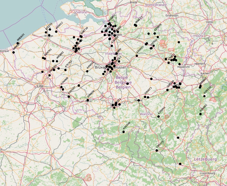
The air quality monitoring networks in Belgium are used for the assessment of air quality under the air quality directives (2008/50/EC & 2004/107/EC).
-
The UrbIS - Points of interest product corresponds to the points of interest dataset for the Brussels Region. This dataset consists of a single geometric class representing these points of interest. The dataset is freely downloadable as zipped files and via the ad hoc WFS.
-

This dataset corresponds to the mesh delimiting the boxes (also called grids) used in UrbIS. The mesh covers the entire territory of the Brussels-Capital Region, and the boxes are one kilometer on each side.
-
Brussels-Capital Region : toponymy public spaces is the name of : - Highways; - Areas of water; - Green areas; - Cemeteries.