 Geobru catalogue
Type of resources
Available actions
Topics
INSPIRE themes
Keywords
Contact for the resource
Provided by
Years
Formats
Representation types
Update frequencies
status
Service types
Scale
Resolution
-
This view service allows, by means of a formatted URL, to visualize UrbIS data from 2023.
-

-
This download service provides object-based access to statistical areas of the Brussels-Capital Region maintained by the Brussels institute for statistics and analysis.
-
This service allows downloading the datasets (compliant with the data specifications of INSPIRE) from the INSPIRE theme "Protected sites" of the Brussels-Capital Region of Brussels Environment.
-
This view service allows, by means of a formatted URL, to display all the vectorial datasets from the "Map of archaeological and historical sites and discoveries" of the Archaeological Subsoil Atlas of the Brussels-Capital Region.
-

This AtomFeed download service provides access to datasets of GAPD that are reported under the INSPIRE Directive. The datasets can be accessible for free or under conditions.
-
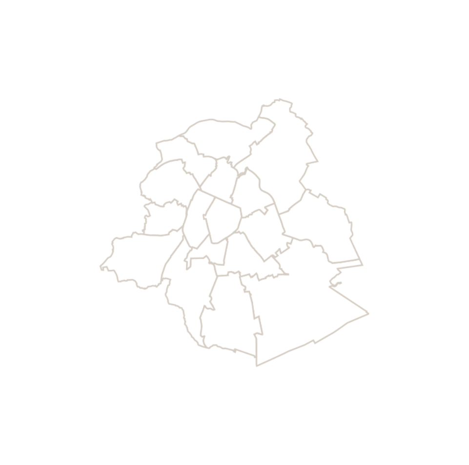
This dataset corresponds to the macrozone dataset, i.e. the highest-level statistical partition of the Brussels-Capital Region (the Region is divided into 17 macrozones).
-
This dataset contains the locations of the wifi.brussels network's hotspots managed by IRISnet in the Brussels-Capital Region.
-
These map layers provide part of the information used for managing urban planning permits within the framework of spatial planning in the Brussels-Capital Region. The perimeters involved are as follows: subdivision permits and urban planning permits issued or still under consideration, municipal regulations and zoned municipal regulations, various zoning areas concerning advertising and signs as well as accessibility related to public transportation from the RRU 2006, land allocated for industry and priority development hubs.
-

Brussels-Capital Region : Railway traffic noise register for the reference year 2021 (noise contours maps) for the Ln acoustic indicator (night-time noise indicator). These maps are produced with an acoustic model in accordance with the prescriptions of the European directive 2002/49/EC.