 Geobru catalogue
Brussels Environment
Type of resources
Available actions
Topics
INSPIRE themes
Keywords
Contact for the resource
Provided by
Years
Formats
Representation types
Update frequencies
status
Service types
Scale
Resolution
-
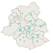
This dataset corresponds to urban agriculture producers. It is made of one geometric classe : the urban agriculture producers's network.
-
This WMS service allows to display Brussels Environment datasets that comply with INSPIRE data specifications relating to INSPIRE theme 'Landcover'.
-
This WMS service allows to display Brussels Environment datasets relating to air, climate and energy
-
This dataset corresponds to Collective and urban kitchen gardens. It is made of one geometric classe : the collective and urban kitchen gardens.
-
This WMS service allows to display Brussels Environment datasets relating to green spaces and biodiversity
-
Brussels-Capital Region: This service is the service mapping data visualization of the dataset Hydrography of Brussels Environment (compliant with the data specifications of INSPIRE) including the watercourse network, drainage basin and surface waters of the Brussels-Capital Region.
-
The publishing of data on Brussels companies with important industrial emissions aims to achieve a high level of environmental protection through integrated prevention and control of pollution from a wide range of industrial and agricultural activities. This complies with the Directive 2010/75/EU of the European Parliament and of the Council of 24 November 2010 on industrial emissions (integrated pollution prevention and control).
-
This WFS service allows to download Brussels Environment datasets relating to water
-
This WFS service allows to download Brussels Environment datasets relating to green spaces and biodiversity
-
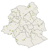
This dataset corresponds to playgrounds and sport equipment in the Brussels-Capital Region. It is made of two geometric classes : public playgrounds and spublic sport equipment.