 Geobru catalogue
imageryBaseMapsEarthCover
Type of resources
Available actions
Topics
INSPIRE themes
Keywords
Contact for the resource
Provided by
Years
Formats
Representation types
Update frequencies
status
Scale
Resolution
-
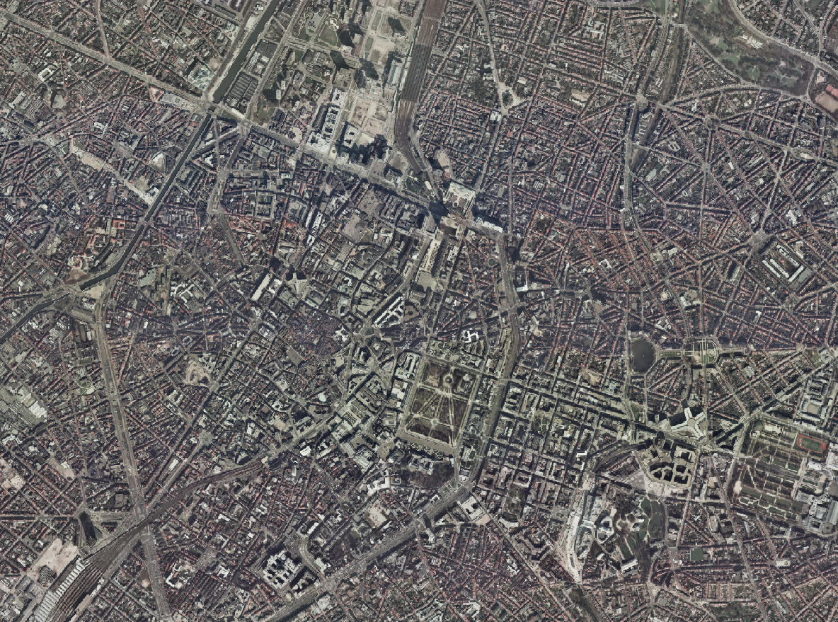
The Brusky Ortho 1996 product is a set of RGB (red, green, blue) orthophotomaps covering the territory of the Brussels Region. The images used for these orthophotoplans were taken in 1996.
-
The Brusky - ground photographs product brings together a collection of historical photographs, taken on the ground or in the immediate vicinity of the ground, of buildings of interest in the current Brussels Region that form part of its remarkable heritage.
-
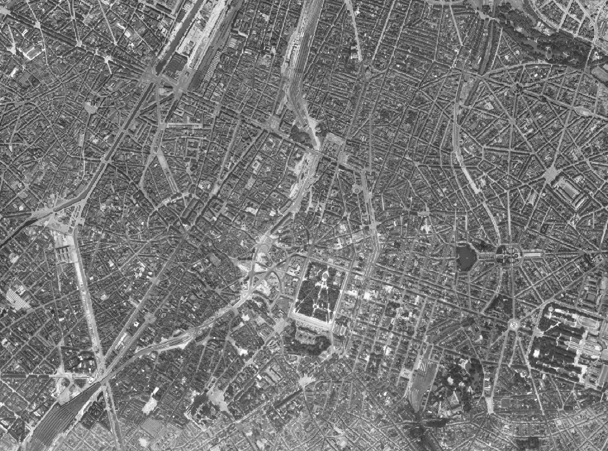
The Brusky Ortho 1953 product is a set of gray scale (black and white) orthophotomaps covering the current territory of the Brussels Region. The images used for these orthophotoplans were taken in 1953. The dataset is freely downloadable as a zipped file.
-
This map corresponds to the "Carte topographique et hypsométrique de Bruxelles et ses environs", drawn around 1858 at a scale of 1:20,000 by Joseph Huvenne (draftsman, topographer) and engraved by J. Ongers. It covers the Brussels region from Neder-Over-Heembeek to Drogenbos and from Berchem-Sainte-Agathe to Auderghem.
-
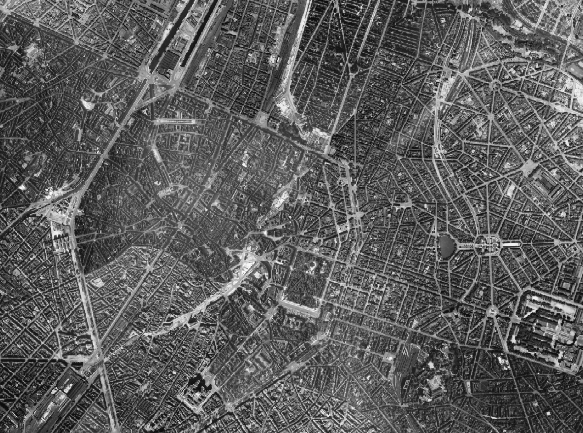
The Brusky Ortho 1944 product is a set of gray scale (black and white) orthophotomaps covering the current territory of the Brussels Region. The images used for these orthophotoplans were taken in 1944. The dataset is provided by the Scottish government.
-

This dataset includes the RGB & NIR (Red, Green, Blue and Near-Infrared) orthophotos created in 2023. The images cover the entire Brussels Capital Region, with a resolution of 40 and 5 centimeters.
-

This dataset includes the RGB & NI (Red, Green, Blue and Near-Infrared) orthophotos created in 2021. The images cover the entire Brussels Capital Region, with a resolution of 5 and 40 centimeters.
-

This dataset includes the RGB & NI (Red, Green, Blue and Near-Infrared) orthophotos created in 2020. The images cover the entire Brussels Capital Region, with a resolution of 5 centimeters.
-

This dataset includes the RGB (Red, Green, Blue) orthophotos created in 2019. The images cover the entire Brussels Capital Region, with a resolution of 5 centimeters.
-

The orthophotos of the Brussels-Capital are made on the basis of large-scale aerial photographs. This orthophoto covers the whole territory of the region. Orthophotos available from 2016.