health
Type of resources
Available actions
Topics
INSPIRE themes
Keywords
Contact for the resource
Provided by
Formats
Representation types
Update frequencies
status
Scale
-
This dataset corresponds to the low emission zone (LEZ) in the Brussels-Capital Region. It is made of two geometric classes : the boundaries of the low emission zone and the transit parkings (P+R) accessible to vehicles that do not meet LEZ access criteria
-
This dataset corresponds to urban heat islands. It 's made of a raster image with each pixel corresponding to a standardised Wet Bulb Globe Temperature (WBGT) indicator value from 0 to 100. This indicator measures heat stress based on temperature, humidity, wind, exposure to solar radiation and cloud cover for a typical hot summer day (i.e. 24 August 2016).
-

Brussels-Capital Region : Road traffic noise register for the reference year 2021 (noise contours maps) for the Lden acoustic indicator (day-evening-night noise indicator). These maps are produced with an acoustic model in accordance with the prescriptions of the European directive 2002/49/EC.
-

Brussels-Capital Region : Road traffic noise register for the reference year 2021 (noise contours maps) for the Ln acoustic indicator (night-time noise indicator). These maps are produced with an acoustic model in accordance with the prescriptions of the European directive 2002/49/EC.
-

Brussels-Capital Region : Air traffic noise map for the reference year 2021 (noise contours maps) for the Lden acoustic indicator (day-evening-night noise indicator). These maps are produced with an acoustic model in accordance with the prescriptions of the European directive 2002/49/EC
-

Brussels-Capital Region : aircraft noise register for the reference year 2021 (noise contours maps) for the Ln acoustic indicator (night-time noise indicator). These maps are produced with an acoustic model in accordance with the prescriptions of the European directive 2002/49/EC
-

Brussels-Capital Region : Railway traffic noise register for the reference year 2021 (noise contours maps) for the Ln acoustic indicator (night-time noise indicator). These maps are produced with an acoustic model in accordance with the prescriptions of the European directive 2002/49/EC.
-

Brussels-Capital Region : Railway traffic noise register for the reference year 2021 (noise contours maps) for the Lden acoustic indicator (day-evening-night noise indicator). These maps are produced with an acoustic model in accordance with the prescriptions of the European directive 2002/49/EC.
-

This dataset corresponds to the noise indicators in the Brussels-Capital Region, in accordance with the requirements of European Directive 2002/49/EC. It comprises 16 geometric classes, broken down according to noise source (air, rail, road or multi-exposure), acoustic indicator (Lden and Ln) and reference year (2016 and 2021).
-

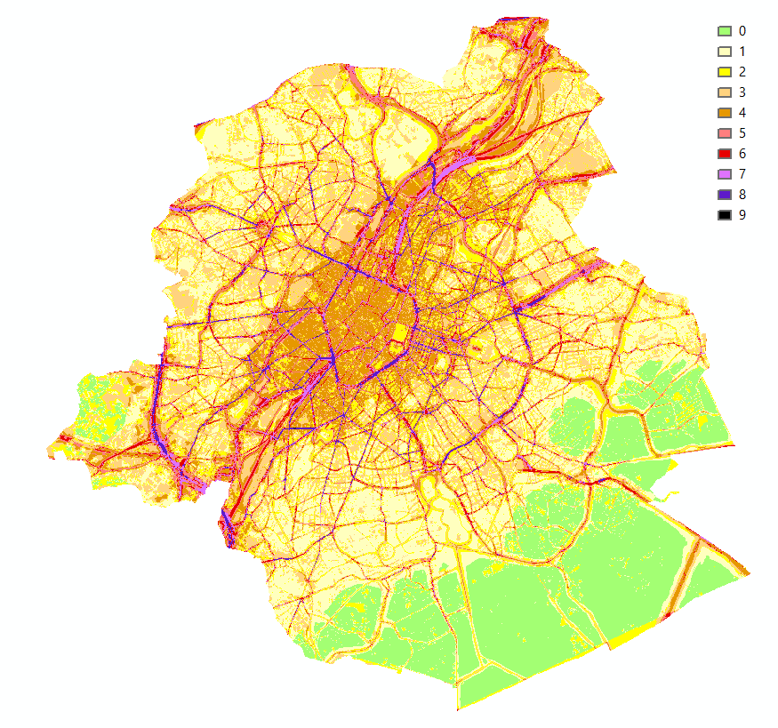
Brussels-Capital Region : This map shows the combined Health Impact Screening score for heat stress, air pollution and noise pollution (0-9) in the Brussels Capital Region. It was produced as part of the 2020 study on the "Impact of 'Nature-Based Solutions' (NBS) on urban residents' exposure to air pollution, noise pollution or high temperatures - Overview of general knowledge and recommendations for the Brussels-Capital Region". This map is a combination of 3 maps: heat stress (24/08/2016), air pollution (2018) and noise pollution (2016). For the methodology used, see p.54. The study report (in dutch) is available at http://document.environnement.brussels/opac_css/elecfile/NatureBasedSolutions
 Geobru catalogue