 Geobru catalogue
noise
Type of resources
Available actions
Topics
INSPIRE themes
Keywords
Contact for the resource
Provided by
Formats
Representation types
Update frequencies
status
Service types
Scale
-
This WMS service allows to display Brussels Environment datasets relating to noise
-

This dataset corresponds to the noise indicators in the Brussels-Capital Region, in accordance with the requirements of European Directive 2002/49/EC. It comprises 16 geometric classes, broken down according to noise source (air, rail, road or multi-exposure), acoustic indicator (Lden and Ln) and reference year (2016 and 2021).
-
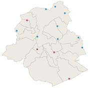
This dataset corresponds to the various monitoring stations sound levels, managed by Brussels Environment. The monitoring stations are dedicated to ambient noise, road, rail and/or air. Indication of the name (corresponding to the location) and the dominant sound source. Measurement results are available via the module WebNoise on the website of Brussels Environment.
-
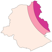
This dataset corresponds to the three aircraft noise restriction zones defined by the order of the Government of the Brussels-Capital Region of 27 May 1999 on the fight against the noise generated by air traffic. It's made of one geometric clas.
-
Brussels-Capital Region: location of the three aircraft noise restriction zones defined by the order of the Government of the Brussels-Capital Region of 27 May 1999 on the fight against the noise generated by air traffic.
-

Brussels-Capital Region: location of various monitoring stations sound levels, managed by Brussels Environment. The monitoring stations are dedicated to ambient noise, road, rail and/or air. Indication of the name (corresponding to the location) and the dominant sound source. Measurement results are available via the module WebNoise on the website of Brussels Environment.
-

Brussels-Capital Region : aircraft noise register for the reference year 2021 (noise contours maps) for the Ln acoustic indicator (night-time noise indicator). These maps are produced with an acoustic model in accordance with the prescriptions of the European directive 2002/49/EC
-

Brussels-Capital Region : Air traffic noise map for the reference year 2021 (noise contours maps) for the Lden acoustic indicator (day-evening-night noise indicator). These maps are produced with an acoustic model in accordance with the prescriptions of the European directive 2002/49/EC
-

Brussels-Capital Region : Railway traffic noise register for the reference year 2021 (noise contours maps) for the Lden acoustic indicator (day-evening-night noise indicator). These maps are produced with an acoustic model in accordance with the prescriptions of the European directive 2002/49/EC.
-

Brussels-Capital Region : Road traffic noise register for the reference year 2021 (noise contours maps) for the Ln acoustic indicator (night-time noise indicator). These maps are produced with an acoustic model in accordance with the prescriptions of the European directive 2002/49/EC.