 Geobru catalogue
Society
Type of resources
Available actions
Topics
INSPIRE themes
Keywords
Contact for the resource
Provided by
Years
Formats
Representation types
Update frequencies
status
Scale
Resolution
-

A request to obtain an advice described as "regarding address lists and GDPR"
-
This dataset contains the locations of the wifi.brussels network's hotspots managed by IRISnet in the Brussels-Capital Region.
-

Conducting a performance audit on the SREA sector
-
These various map layers are essential for the effective management of cultural heritage (real estate) in the Brussels-Capital region. They enable authorities and stakeholders to monitor, protect, and promote this valuable cultural legacy. Protected Properties: This map layer displays the locations of cultural properties that are officially protected by the relevant authorities. Protection Zones: This map layer shows the designated protection zones around the protected properties.
-
This layer shows the locations of monuments, ensembles, trees, and sites listed in legal inventories.
-
This dataset shows, for each Brussels municipality, the projected population by age and sex, over the period from 2026 to 2035. The population projections are carried out according to the methodologies described in the Cahier of the BISA No. 13.
-
The studies documented here were commissioned by Innoviris and focus on the theme of well-being and living together in the Brussels-Capital Region. The first publications date back to 2018, and new studies are added to this collection each year. The topics covered span a wide range of issues, from social cohesion to mental health, and from citizen participation to inequalities in access to healthcare. The studies are available for direct download. Most documents are available in French and Dutch, but some are only available in English.
-
This dataset includes the roads cleaned by the Regional Agency for Cleanliness (“Brussels-Cleanliness”) that are not regional roads.
-
This dataset is made up of numerous types of objects corresponding to a range of different layouts or the location of various buildings or activities.
-
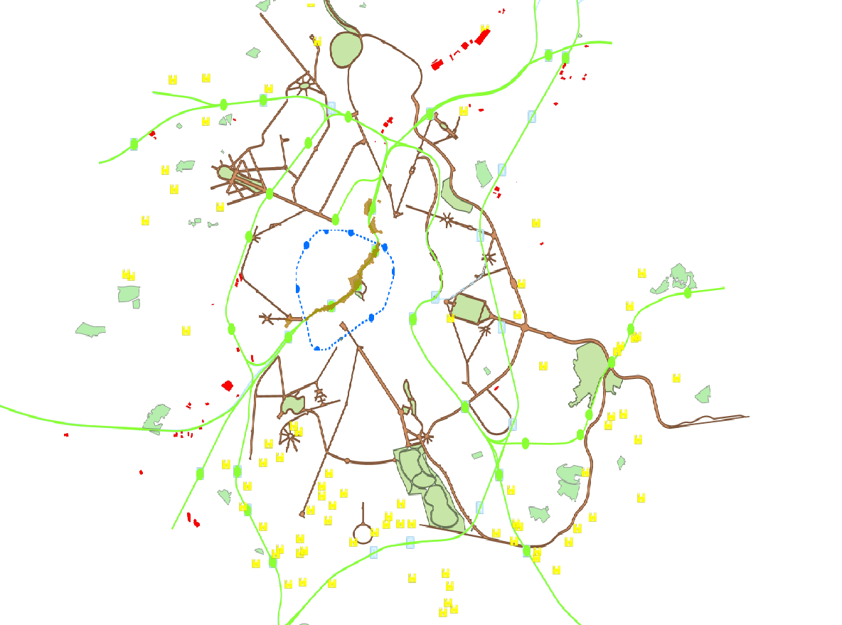
These map layers provide a detailed representation of archaeological sites from prehistory to the 18th century and enable efficient management of regional preventive archaeology. Archaeological Atlas : These map layers list archaeological sites and discoveries as well as an expansion zone of human settlements around the main remains. Archaeological and Historical Inventory : These map layers present the thematic inventory of a series of sites confirmed by archaeology and historical sources (monasteries, monastic refuges, breweries, cellars…).