 Geobru catalogue
2003
Type of resources
Available actions
Topics
INSPIRE themes
Keywords
Contact for the resource
Provided by
Years
Formats
Representation types
Update frequencies
status
Scale
-
The indicative inventory of natural heritage: these various cartographic layers are essential for a comprehensive understanding of natural heritage, allowing authorities and stakeholders to monitor, protect, and promote trees and sites with heritage value (gardens, squares, parks, woods) in the region. The inventory of architectural heritage. The archaeological and historical inventory of the Brussels Region: this group of cartographic layers presents a detailed thematic inventory of archaeological and historical sites in the center of Brussels (Pentagon).
-
These various map layers are essential for the effective management of cultural heritage (real estate) in the Brussels-Capital region. They enable authorities and stakeholders to monitor, protect, and promote this valuable cultural legacy. Protected Properties: This map layer displays the locations of cultural properties that are officially protected by the relevant authorities. Protection Zones: This map layer shows the designated protection zones around the protected properties.
-
This layer shows the locations of monuments, ensembles, trees, and sites listed in legal inventories.
-
These map layers provide a detailed representation of archaeological sites from prehistory to the 18th century and enable efficient management of regional preventive archaeology. Archaeological Atlas : These map layers list archaeological sites and discoveries as well as an expansion zone of human settlements around the main remains. Archaeological and Historical Inventory : These map layers present the thematic inventory of a series of sites confirmed by archaeology and historical sources (monasteries, monastic refuges, breweries, cellars…).
-
Brussels-Capital Region : this directive has as an aim the prevention of the major accidents implying of dangerous substances and the limitation of their consequences for the man and the environment, in order to ensure in a coherent and effective way in all the country of the high levels of protection. The geographical data file SEVESO consists of several classes of objects which make it possible to locate all the SEVESO sites on the territory of the area of Brussels.
-
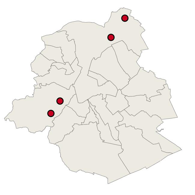
Brussels-Capital Region: localization of the extraction wells for drinking water in Brussels, run by VIVAQUA. Ranked as protected area 1 of the water extractions (with the drainage gallery)
-
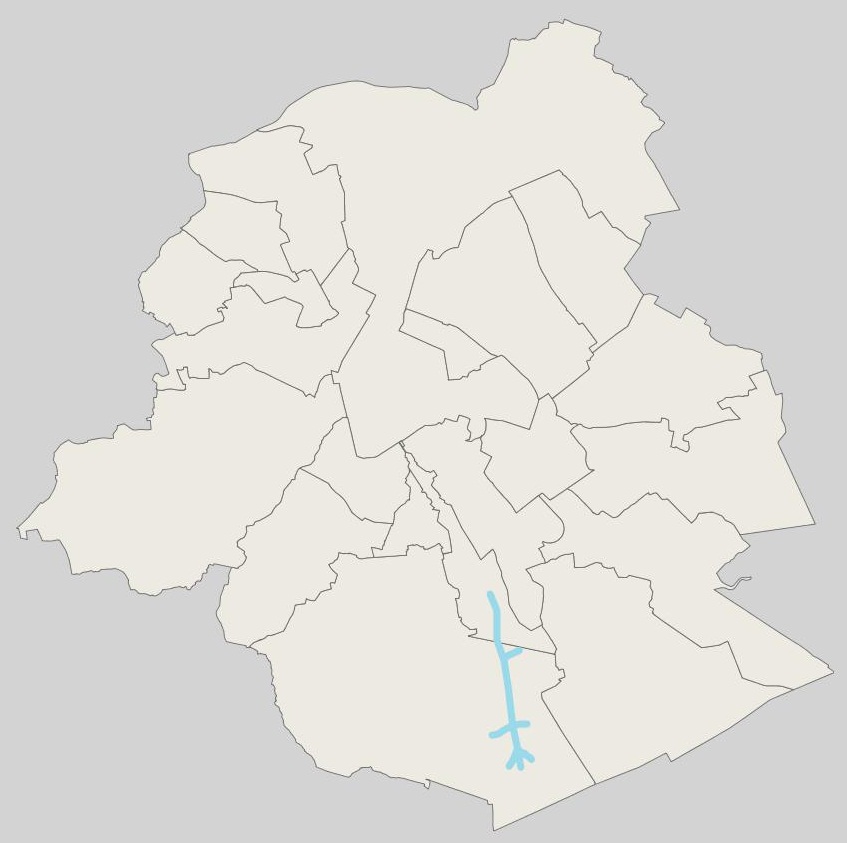
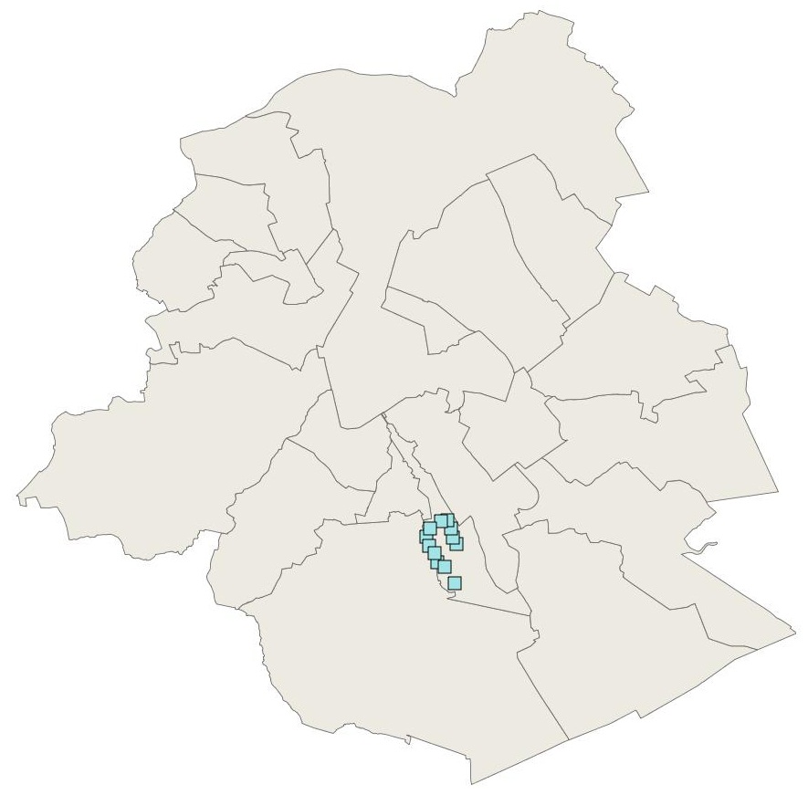
Brussels-Capital Region : location of Brussels drinking water catchment drainage gallery operated by VIVAQUA. Each section of the drainage gallery is named. Classified as protection area 1 of water extraction (with the extraction wells).