 Geobru catalogue
land use
Type of resources
Available actions
Topics
INSPIRE themes
Keywords
Contact for the resource
Provided by
Years
Formats
Representation types
Update frequencies
status
Service types
Scale
-
This view service allows, by means of a formatted URL, to visualize data in Dutch managed by perspective.brussels.
-
This download service allows, by means of a formatted URL, to download each object from the data in Nederlands managed by perspective.brussels.
-
This view service allows, by means of a formatted URL, to visualize data in French managed by perspective.brussels.
-
This download service allows, by means of a formatted URL, to download each object from the data in French managed by perspective.brussels.
-
This dataset corresponds to the sensitivity classes applicable to the soil condition inventory, defined according to the Regional Land Use Plan (2017) and according to the correspondence established in the decree of 29 March 2018 determining intervention standards and sanitation standards. Soil pollution response standards are derived from this. The sensitivity class is to be adapted to 'special area' if the site under study is in a Natura 2000 area or in a drinking water catchment protection area. The dataset specifies whether the site is yes (t=true) or no (f=false) in such an area. There are 6 different sensitivity classes: (1) residential, (2) particular, (3) industrial, (4) ZFM and ZEMU, (5) ZIR, ZIRAD and RF, (6) other.
-
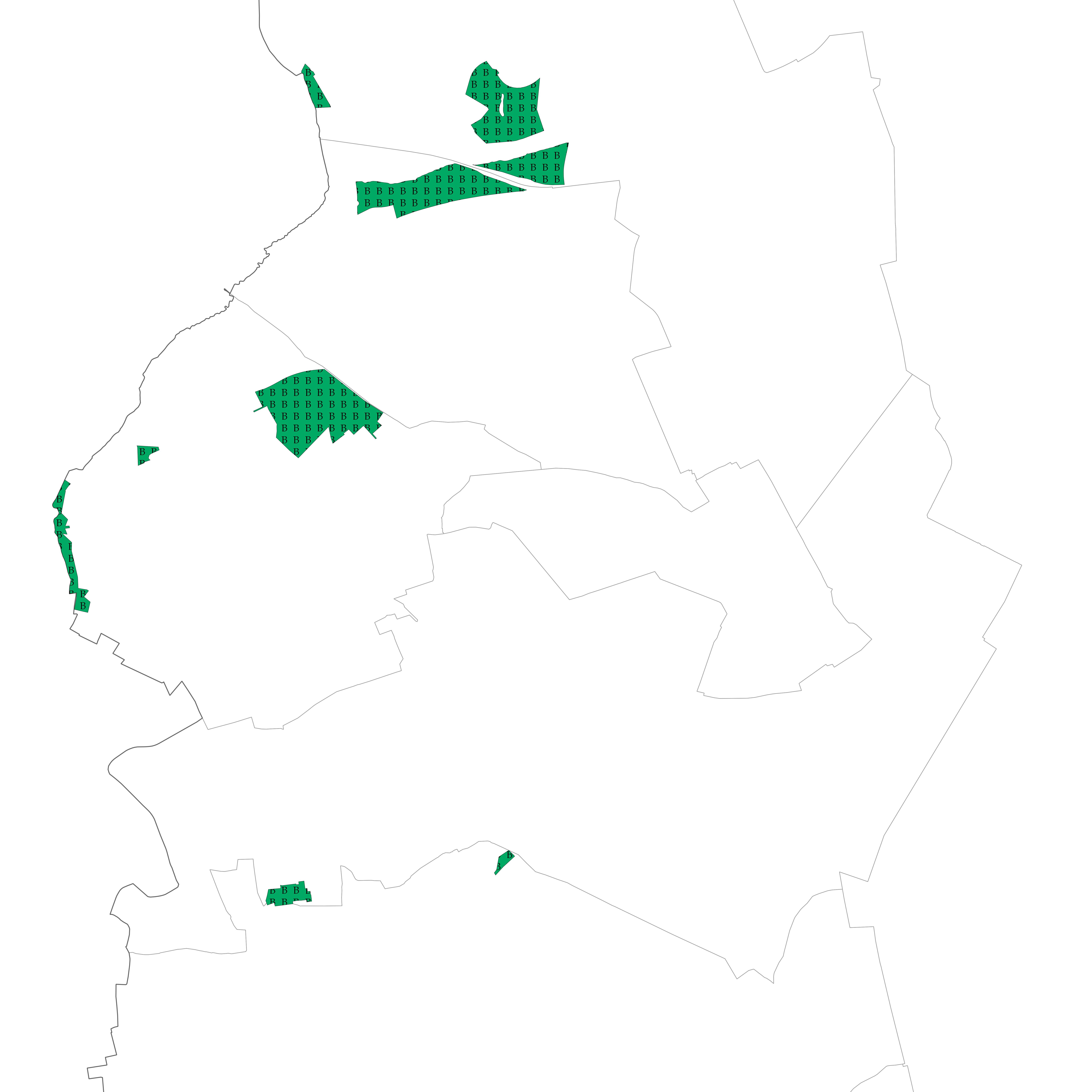
Brussels-Capital Region : Areas intended for the conservation and the regeneration of a natural environment that is of high biological value as it shelters rare animal and vegetable species or boasts considerable biological diversity
-
Brussels-Capital Region : database of green spaces and recreational areas in the Brussels-Capital Region, accessible to the public
-
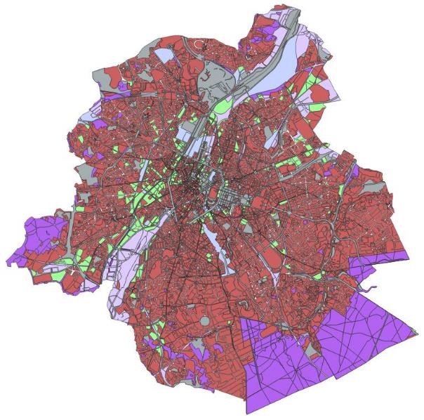
This dataset represents the land use zoning elements set out in the map of the Regional Land Use Plan (le Plan Régional d’Affectation du Sol or PRAS in French and het Gewestelijk Bestemmingsplan or GBP in Dutch). It consists of a single geometry layer showing the zoning elements (without the overlays of the zone of regional interest with deferred development and of the zones of cultural, historical, aesthetic or embellishment interest). All PRAS layers are freely available via an ad hoc WMS and WFS. This dataset has no regulatory value and is published for information purposes only. Only the maps and subsequent amendments published in the Belgian Official Gazette have regulatory force.
-
This dataset corresponds to soil condition inventory in the Brussels-Capital Region. It is made up of one geometric classe : cadastral parcels categorised according to a presumption of pollution and any studies and work to treat soil pollution
-
This dataset corresponds to analyses and suspicion of contamination of water and soil in the Brussels-Capital Region. It is made up of two objects: cadastral parcels presenting a risk of pollution by PFAS and the results of analysis campaigns by borehole