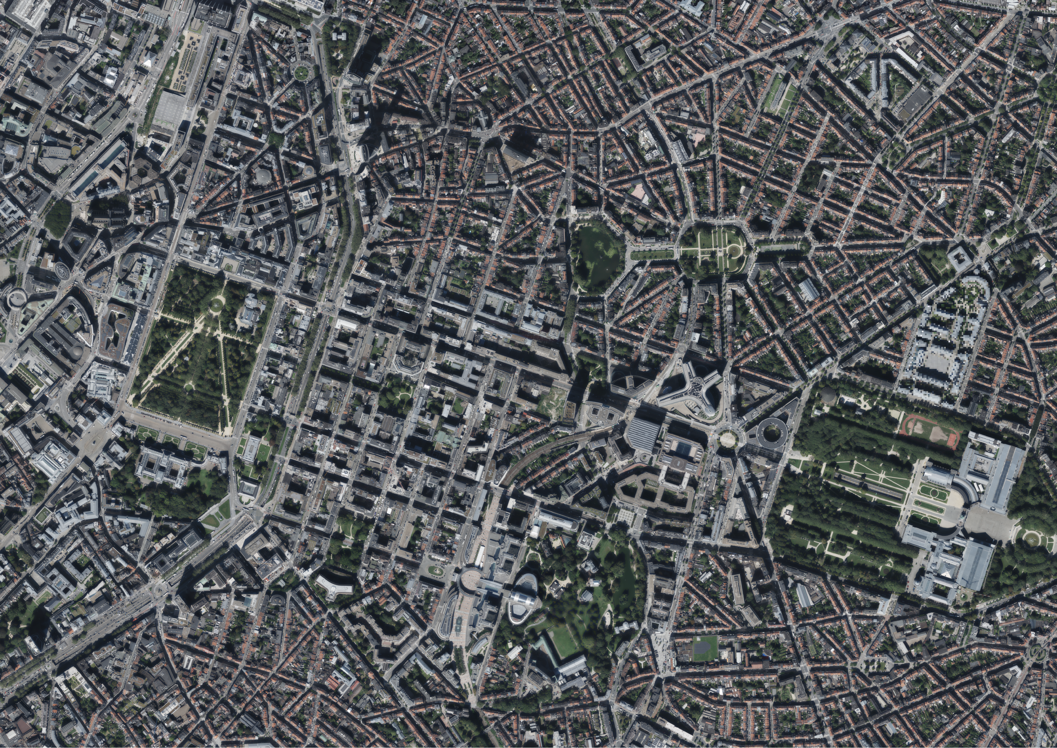
Orthophoto - 2023
This dataset includes the RGB & NIR (Red, Green, Blue and Near-Infrared) orthophotos created in 2023. The images cover the entire Brussels Capital Region, with a resolution of 40 and 5 centimeters.
Simple
- Date (Creation)
- 2023-12-01
- Date (Revision)
- 2023-12-01
- Identifier
- CIRB-CIBG / f32f4c46-e11a-11ee-ae8e-00090ffe0001
- Status
- Completed
- Maintenance and update frequency
- Not planned
- Access constraints
- Other restrictions
- Other constraints
- No limitations to public access
- Use constraints
- Other restrictions
- Spatial representation type
- Grid
- Distance
- 5 cm
- Metadata language
- English
- Metadata language
- Nederlands; Vlaams
- Metadata language
- Français
- Character set
- UTF8
- Topic category
-
- Imagery base maps earth cover
- Description
- Brussels-Capital Region
N
S
E
W
))
- Unique resource identifier
- EPSG:31370
- Codespace
- EPSG
- Unique resource identifier
- EPSG:3812
- Codespace
- EPSG
- Distribution format
-
-
ECW
()
-
TIFF
()
-
ECW
()
- OnLine resource
- https://geoservices-urbis.irisnet.be/geoserver/urbisgrid/ows?request=GetCapabilities&service=WMS&version=1.3.0 ( OGC:WMS )
- OnLine resource
- OnLine resource
- https://urbisdownload.datastore.brussels/atomfeed/f32ea605-e11a-11ee-bcc0-00090ffe0001-en.xml ( ATOM )
- Statement
- The data collection flights took place in the Brussels Capital Region on an East-West axis on 23 August and 6 September 2023. The images were taken using an UltraCam Eagle Mark3 multispectral camera with a 120 mm focal length on the first flight, and an UltraCam Eagle Mark3 multispectral camera with a 210 mm focal length on the second flight, both with a four-channels' sensor: R, G, B & NI (Red, Green, Blue, and Near-Infrared). The flights took place at an average altitude of 1250 meters. An orthorectification process eliminates distortions caused by relief and perspective, allowing UrbIS vector layers to be superimposed on orthophotos or measurements to be made directly on the images.
- File identifier
- f32ea605-e11a-11ee-bcc0-00090ffe0001 XML
- Metadata language
- English
- Character set
- UTF8
- Hierarchy level
- Dataset
- Date stamp
- 2024-03-28T06:42:28
- Metadata standard name
- Brussels INSPIRE metadata profil
Overviews

Spatial extent
N
S
E
W
))
Provided by

Associated resources
Not available
 Geobru catalogue