 Geobru catalogue
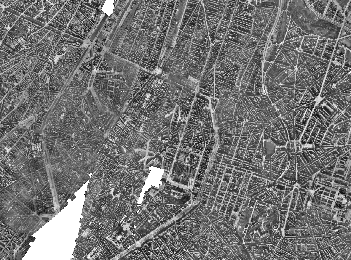
Brusky - Ortho 1930-1935
The Brusky Ortho 1930-1935 product is a set of gray scale (black and white) orthophotomaps covering apart of the current territory of the Brussels Region. The images used for these orthophotoplans were taken between 1930 and 1935.
Simple
- Date (Creation)
- 2022-12-01
- Date (Revision)
- 2022-12-01
- Identifier
- BE.BRUSSELS.URBAN / 645cac17-d265-11ee-a34f-40ec994184cf
- Status
- Completed
- Maintenance and update frequency
- Not planned
- Access constraints
- Other restrictions
- Other constraints
- public access limited according because of existing intellectual rights
- Use constraints
- Other restrictions
- Other constraints
- Creative Commons Attribution (CC-BY) - required citation of data source. The full license is available here: https://creativecommons.org/licenses/by/4.0/legalcode
- Spatial representation type
- Grid
- Distance
- 10 m
- Metadata language
- Nederlands; Vlaams
- Metadata language
- Français
- Character set
- UTF8
- Topic category
-
- Imagery base maps earth cover
- Description
- Brussels-Capital Region
N
S
E
W
))
- Unique resource identifier
- EPSG:31370
- Codespace
- EPSG
- Distribution format
-
-
TIFF
()
-
TIFF
()
- Hierarchy level
- Dataset
- Statement
- This dataset is based on flights taken in 1930 and 1935 for the Belgian Ministry of Public Works (Topography and Photogrammetry Service). The photographs from 1930 are held in the form of positives and/or negatives in the urban.brussels collections. For 1935, some are held in the Flemish Government Archives, at the Department of Mobility and Public Works, General Technical Support. The 1930 flight took place on 1 December on a North-North-East / South-South-West axis, at an undetermined altitude. The 1935 flights took place on 15 and 19 February on a North-North-East / South-South-West route, also at an undetermined altitude.
- File identifier
- 64591fd2-d265-11ee-ba69-40ec994184cf XML
- Metadata language
- English
- Character set
- UTF8
- Hierarchy level
- Dataset
- Date stamp
- 2026-06-18T10:06:21
- Metadata standard name
- Brussels INSPIRE metadata profil
Overviews
Spatial extent
N
S
E
W
Provided by

Associated resources
Not available