 Geobru catalogue
hydrography
Type of resources
Available actions
Topics
INSPIRE themes
Keywords
Contact for the resource
Provided by
Years
Formats
Representation types
Update frequencies
status
Service types
Scale
-

Brussels-Capital Region : watercrouse links in Brussels Region, defined under the Directive and the Ordinance Water
-
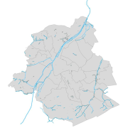
This dataset corresponds to hydrography in the Brussels-Capital Region. It is made up of nine geometric classes: drainage basins, arched watercourses, open watercourses, surface water (ponds, marshes, swamps), surface water bodies, springs, right-of-way zone for arched watercourses, non aedificandi zone.
-

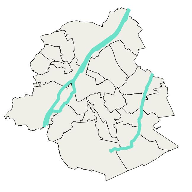
Brussels-Capital Region : watercrouses in Brussels Region, defined under the Directive and the Ordinance Water
-
This dataset corresponds to the atlas of the hydrographic network of the Brussels-Capital Region, in accordance with the Decree of 23 May 2024 classifying non-navigable watercourses, designating regional ponds, determining the content, scope, procedures and deadlines for drawing up the Atlas of the hydrographic network of the Brussels-Capital Region and adopting this Atlas. It is made of ten geometric classes: classified watercourses, unclassified watercourses, bank crests, regional ponds, ditches, engineering structures, sluice walls, watercourse points of origin, cross profiles, embankments.
-
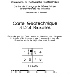
Brussels-Capital Region: The geotechnical maps of Brussels were elaborated by J.P. Dam, under the direction of prof. J. Nuyens, V. Roisin and R. Thonnard of the Université Libre de Bruxelles (ULB) and of the Vrije Universiteit Brussel (VUB), members of the Centre Interuniversitaire pour la Cartographie Géotechnique directed by J. Nuyens (ULB). They were then published at a scale of 1/5000 between 1976 and 1990 by the ‘Institut Géotechnique de l’Etat’ (State Geotechnical Institute). The constituent documents (maps and associated reports) provide an overview of the following points: - tests carried out in the region ; - depth of the water table ; - nature and position of the tertiary substratum ; - nature and strength of the various surface layers; - units with a specific overlay of the formations encountered. Their initial objective was to respond to the needs of the builders for synthetic and easily accessible documentation relating to the subsoil of the Brussels region. The plates and documents provided did not claim absolute precision because of the interpolations and extrapolations necessary for their establishment. The present archive is presented in three forms: - Digitized maps and associated FR/NL explanatory notes .pdf ; - Georeferenced 'raster' maps (lambert 72); - Vector' maps (lambert 72). List of available maps: 31.2.4; 31.2.6; 31.2.8; 31.3.1; 31.3.2; 31.3.3; 31.3.4; 31.3.5; 31.3.6; 31.3.7; 31.3.8; 31.4.7; 31.7.1; 31.7.2; 31.7.3.
-

Brussels-Capital Region : drainage basins in Brussels Region, defined under the Directive and the Ordinance Water
-

Brussels-Capital Region : standing Water in Brussels Region, defined under the Directive and the Ordinance Water
-
Brussels-Capital Region : data on the 3 Surface Water Bodies of the Area of Brussels, defined under the Directive and the Ordinance Water
-
CartoWeb.be is a Web Service (WMTS/WMS) containing cartographic representations covering 11 scale levels. CartoWeb.be offers a cartographic representation which has been developed specifically for on-screen viewing of the NGI’s most recent vector data sets. Three versions are available for the Belgian territory: 1) a TOPO layer containing a cartographic representation at all scales; 2) a TOPO-GREY layer, which is the symbolisation in different shades of grey and blue of the TOPO layer. It constitutes an ideal map background; 3) an OVERLAY (1:2 500 - 1:25 000) layer destined to be used as an overlay on other data (orthophotographs for instance). This layer contains the symbolisation of a few layers only. Two other layers, CROSSBORDER and CROSSBORDER-GREY, are available in order to allow viewing (only on the smallest scales 1:100 000 – 1:4 000 000) the European context of Belgium. The extent of this representation is limited and could change in the following versions. It is best to combine the CROSSBORDER layer with the TOPO layer. It is best to combine the CROSSBORDER-GREY layer with the TOPO-GREY-layer.