 Geobru catalogue
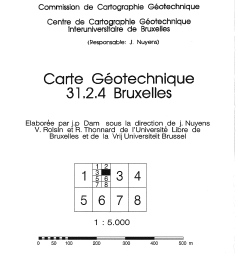
Geotechnical maps of Brussels (vector, raster)
Brussels-Capital Region: The geotechnical maps of Brussels were elaborated by J.P. Dam, under the direction of prof. J. Nuyens, V. Roisin and R. Thonnard of the Université Libre de Bruxelles (ULB) and of the Vrije Universiteit Brussel (VUB), members of the Centre Interuniversitaire pour la Cartographie Géotechnique directed by J. Nuyens (ULB). They were then published at a scale of 1/5000 between 1976 and 1990 by the ‘Institut Géotechnique de l’Etat’ (State Geotechnical Institute). The constituent documents (maps and associated reports) provide an overview of the following points: - tests carried out in the region ; - depth of the water table ; - nature and position of the tertiary substratum ; - nature and strength of the various surface layers; - units with a specific overlay of the formations encountered. Their initial objective was to respond to the needs of the builders for synthetic and easily accessible documentation relating to the subsoil of the Brussels region. The plates and documents provided did not claim absolute precision because of the interpolations and extrapolations necessary for their establishment. The present archive is presented in three forms: - Digitized maps and associated FR/NL explanatory notes .pdf ; - Georeferenced 'raster' maps (lambert 72); - Vector' maps (lambert 72). List of available maps: 31.2.4; 31.2.6; 31.2.8; 31.3.1; 31.3.2; 31.3.3; 31.3.4; 31.3.5; 31.3.6; 31.3.7; 31.3.8; 31.4.7; 31.7.1; 31.7.2; 31.7.3.
Simple
- Date (Publication)
- 2021-02-26
- Date (Revision)
- 2021-02-26
- Date (Creation)
- 2021-02-26
- Identifier
- BE.BELB / BRU_ENVI_67dfc839-3289-46bf-a3f2-dd03bfeb053e
- Status
- Completed
- Maintenance and update frequency
- Not planned
- GeoBru Administrative Regions
-
- Belgium
- Région de Bruxelles-Capitale
- Access constraints
- Other restrictions
- Other constraints
- No limitations to public access
- Use constraints
- Other restrictions
- Other constraints
- Creative Commons Attribution (CC-BY) - required citation of data source. The full license is available here: https://creativecommons.org/licenses/by/4.0/legalcode
- Spatial representation type
- Vector
- Denominator
- 5000
- Metadata language
- Français
- Topic category
-
- Geoscientific information
N
S
E
W
))
- gml32:beginPosition
- 1971-01-01
- gml32:endPosition
- 1990-12-31
- Unique resource identifier
- EPSG:31370
- Distribution format
-
-
ZIP
(
1
)
-
ZIP
(
1
)
- OnLine resource
-
Georeferenced 'vector' geotechnical maps
(
WWW:DOWNLOAD-1.0-http--download
)
Download link for the vector dataset
- OnLine resource
-
Georeferenced 'raster' geotechnical maps
(
WWW:DOWNLOAD-1.0-http--download
)
Download link for the raster dataset
- OnLine resource
-
Digitized maps and associated FR/NL explanatory notes .pdf
(
WWW:DOWNLOAD-1.0-http--download
)
Download link pdf
- Hierarchy level
- Dataset
Conformance result
- Date (Publication)
- 2010-12-08
- Explanation
- The dataset does not fullfill the minimal requirements
- Pass
- No
- Statement
- The geotechnical maps of Brussels were elaborated by J.P. Dam, under the direction of prof. J. Nuyens, V. Roisin and R. Thonnard of the Université Libre de Bruxelles (ULB) and of the Vrije Universiteit Brussel (VUB), members of the Centre Interuniversitaire pour la Cartographie Géotechnique directed by J. Nuyens (ULB). They were then published at a scale of 1/5000 between 1976 and 1990 by the ‘Institut Géotechnique de l’Etat’ (State Geotechnical Institute).
- File identifier
- 67dfc839-3289-46bf-a3f2-dd03bfeb053e XML
- Metadata language
- Français
- Character set
- MD_CharacterSetCode_utf8
- Hierarchy level
- Dataset
- Date stamp
- 2025-12-09T17:24:07
- Metadata standard name
- ISO19115
- Metadata standard version
- 2003/Cor.1:2006
Overviews
Spatial extent
N
S
E
W
Provided by

Associated resources
Not available