Directive 2000/60/EC
Type of resources
Available actions
Topics
INSPIRE themes
Keywords
Contact for the resource
Provided by
Years
Formats
Representation types
Update frequencies
status
Service types
Scale
-
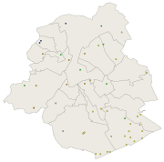
Brussels-Capital Region : location of the different groundwater level monitoring sites (or piezometric sites) managed by Brussels Environment under the surveillance monitoring of the groundwater status in accordance with the Ordonnance and the Water Framework Directive. Indication of the analyzed water body, the European Code and the Brussels code of the monitoring site.
-
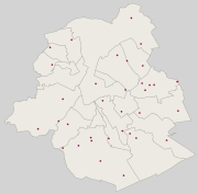
Brussels-Capital Region : location of the different groundwater quality monitoring sites managed by Brussels Environment and which results are transmitted through the reporting to Europe (under Article 8 of the Water Framework Directive). Indication of the analyzed water body, the European Code and the Brussels code of the monitoring site. Distinction between two types of monitoring: surveillance monitoring for all groundwater bodies (type_monitoring = 1) and operational monitoring for groundwater bodies identified as being at risk of failing to achieve the objectives of good status (type_monitoring = 2)
-

Brussels-Capital Region : location of the different groundwater quality monitoring sites managed by Brussels Environment and which results are transmitted through the reporting to Europe (under Article 8 of the Water Framework Directive). Indication of the analyzed water body, the European Code and the Brussels code of the monitoring site. Distinction between two types of monitoring: surveillance monitoring for all groundwater bodies (type_monitoring = 1) and operational monitoring for groundwater bodies identified as being at risk of failing to achieve the objectives of good status (type_monitoring = 2)
-
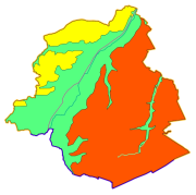
This dataset corresponds to the groundwaterbodies in the Brussels-Capital Region, in accordance with Directive 2000/60/EC of the European Parliament and of the Council of 23 October 2000 establishing a framework for Community action in the field of water policy (Water Framework Directive). It is made up of one geometric class: groundwaterbodies.
-

Brussels-Capital Region : data on the 5 Groundwaterbody of the Area of Brussels, defined under the Directive and the Ordinance Water : code European, code of Brussels and name of the water mass, hydrographic district
-

Brussels-Capital Region : location of the different groundwater level monitoring sites (or piezometric sites) managed by Brussels Environment under the surveillance monitoring of the groundwater status in accordance with the Ordonnance and the Water Framework Directive. Indication of the analyzed water body, the European Code and the Brussels code of the monitoring site.
-
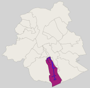
Brussels-Capital Region : groundwater catchment sites protection area 3 (i.e. extraction wells and drainage gallery) in the Brussels-Capital Region. Those site was defined in the Brussels-Capital Government decree of 19 September 2002 delimiting a groundwater catchments protection area at the “Bois de la Cambre” and in the Sonian Forest (Belgian Monitor: June 10, 2008)
-
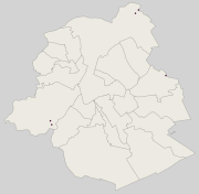
Brussels-Capital Region : location of the different surface water quality monitoring sites under the Water Framework Ordonnance and Directive. Surface waters concerned are surface water bodies: Canal, Senne and Woluwe. Monitoring involves a series of chemical, physico-chemical parameters... The code and the name of the monitoring site are given.
-

Brussels-Capital Region : location of the different surface water biological quality monitoring sites under the Water Framework Ordonnance and Directive. Surface waters concerned are surface water bodies: Canal, Senne and Woluwe. Monitoring involves a series of biological parameters.
-
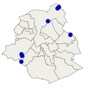
Brussels-Capital Region : location of the different surface water biological quality monitoring sites under the Water Framework Ordonnance and Directive. Surface waters concerned are surface water bodies: Canal, Senne and Woluwe. Monitoring involves a series of biological parameters.
 Geobru catalogue