 Geobru catalogue
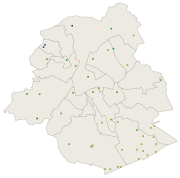
Groundwater level monitoring network - European reporting
Simple
- Date (Publication)
- 2007-07-09
- Date (Revision)
- 2012-12-31
- Date (Creation)
- 2007-07-09
- Identifier
- BE.BELB / BRU_ENVI_stationsGW_controles_2007.xml
- Maintenance and update frequency
- As needed
- GeoBru Administrative Regions
-
- Belgium
- Région de Bruxelles-Capitale
- GeoBru brussels keywords
-
- Public Space
- Reporting Inspire
- INSPIRE feature concept dictionary
-
- Environmental Monitoring Facility
- Spatial scope
-
- Regional
- Access constraints
- Other restrictions
- Other constraints
- No limitations to public access
- Use constraints
- Other restrictions
- Other constraints
- Creative Commons Attribution (CC-BY) - required citation of data source. The full license is available here: https://creativecommons.org/licenses/by/4.0/legalcode
- Spatial representation type
- Vector
- Denominator
- 500
- Metadata language
- Français
- Metadata language
- Nederlands; Vlaams
- Topic category
-
- Structure
))
- gml32:beginPosition
- 2007-01-05
- gml32:endPosition
- 2024-01-01
- Unique resource identifier
- EPSG:3035
- Distribution format
-
-
GML
()
-
GML
()
- Units of distribution
- B
- Transfer size
- 1
- OnLine resource
-
bruenvi_water_monitoring_groundwater_level_reporting
(
WWW:DOWNLOAD-1.0-http--download
)
Download link for the dataset
- OnLine resource
-
bruenvi_water_monitoring_groundwater_level_reporting
(
OGC:WFS
)
Download service (WFS) of INSPIRE 'as is' data from Brussels Environment
- OnLine resource
-
bruenvi_water_monitoring_groundwater_level_reporting
(
OGC:WMS
)
View service (WMS) of INSPIRE 'as is' data from Brussels Environment
- Hierarchy level
- Dataset
Conformance result
- Date (Publication)
- 2010-12-08
- Explanation
- The dataset does not fullfill the minimal requirements
- Pass
- No
- Statement
- Bruxelles Environnement / Leefmilieu Brussel
- File identifier
- stationsGW_controles_2007.xml XML
- Metadata language
- Français
- Character set
- MD_CharacterSetCode_utf8
- Hierarchy level
- Dataset
- Date stamp
- 2024-03-08T13:01:21
- Metadata standard name
- ISO19115
- Metadata standard version
- 2003/Cor.1:2006
Overviews

Spatial extent
Provided by
