 Geobru catalogue
Protection area 1 of water extraction - drainage gallery
Brussels-Capital Region : location of Brussels drinking water catchment drainage gallery operated by VIVAQUA. Each section of the drainage gallery is named. Classified as protection area 1 of water extraction (with the extraction wells).
Simple
- Date (Publication)
- 2003-01-01
- Date (Revision)
- 2009-04-24
- Date (Creation)
- 2003-01-01
- Identifier
- BE.BELB / BRU_ENVI_Zone1_protection_captage_galerie.xml
- Maintenance and update frequency
- As needed
- GeoBru Administrative Regions
-
- Belgium
- Région de Bruxelles-Capitale
- GeoBru brussels keywords
-
- Reporting Inspire
- Spatial scope
-
- Regional
- Access constraints
- Other restrictions
- Use constraints
- Other restrictions
- Other constraints
- Creative Commons Attribution (CC-BY) - required citation of data source. The full license is available here: https://creativecommons.org/licenses/by/4.0/legalcode
- Spatial representation type
- Vector
- Denominator
- 500
- Metadata language
- Français
- Topic category
-
- Environment
N
S
E
W
))
- gml32:beginPosition
- 2003-01-01
- gml32:endPosition
- 2024-01-01
- Unique resource identifier
- EPSG:3035
- Distribution format
-
-
GML
()
-
GML
()
- Hierarchy level
- Dataset
Conformance result
- Date (Publication)
- 2010-12-08
- Explanation
- The dataset does not fullfill the minimal requirements
- Pass
- No
- Statement
- Bruxelles Environnement / Leefmilieu Brussel
- File identifier
- Zone1_protection_captage_galerie.xml XML
- Metadata language
- Français
- Character set
- MD_CharacterSetCode_utf8
- Hierarchy level
- Dataset
- Date stamp
- 2023-12-15T13:59:03
- Metadata standard name
- ISO19115
- Metadata standard version
- 2003/Cor.1:2006
Overviews
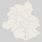
thumbnail
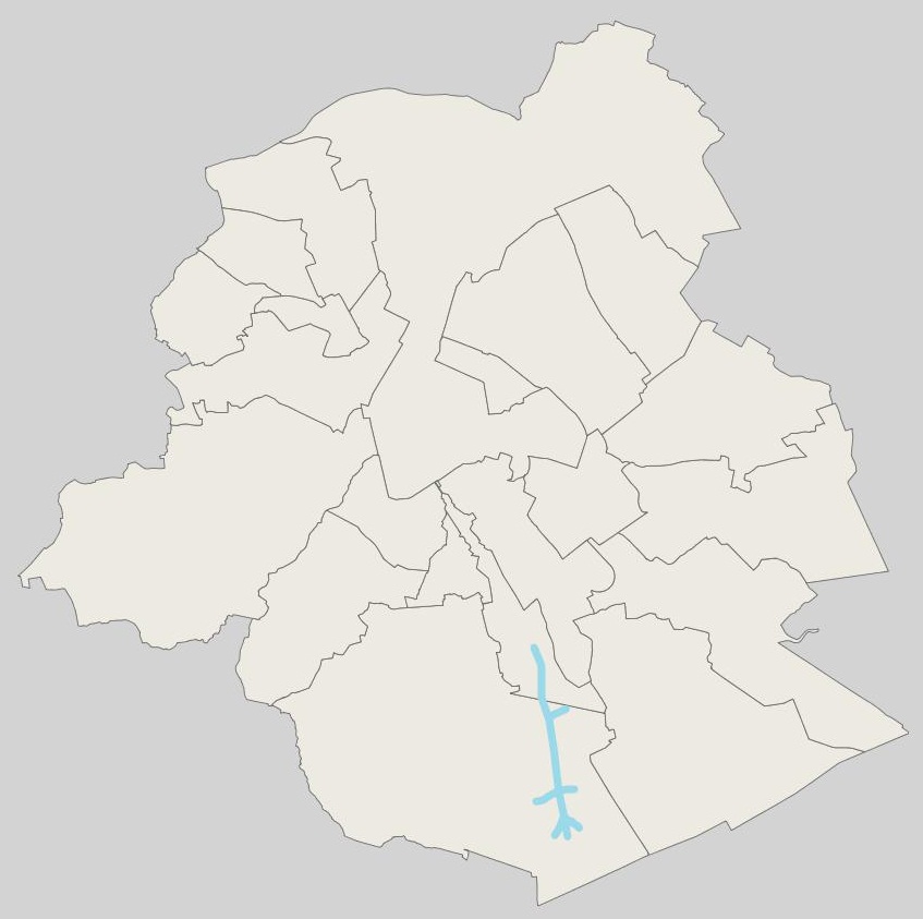
large_thumbnail
Spatial extent
N
S
E
W
Provided by

Associated resources
Not available