Management Restriction Or Regulation Zone
Type of resources
Available actions
Topics
INSPIRE themes
Keywords
Contact for the resource
Provided by
Years
Formats
Representation types
Update frequencies
status
Scale
-
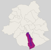
Brussels-Capital Region : groundwater catchment sites protection area 3 (i.e. extraction wells and drainage gallery) in the Brussels-Capital Region. Those site was defined in the Brussels-Capital Government decree of 19 September 2002 delimiting a groundwater catchments protection area at the “Bois de la Cambre” and in the Sonian Forest (Belgian Monitor: June 10, 2008)
-
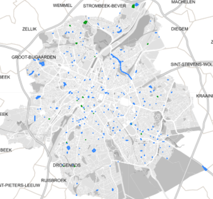
Spatial representation of building permits in the Brussels region
-
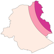
Brussels-Capital Region: location of the three areas of limitation of aircraft noise defined by the order of the Government of the Brussels-Capital Region of 27 May 1999 on the fight against the noise generated by air traffic.
-

Brussels-Capital Region: Delineation of the Brussels agglomeration, in accordance with the directive 91/271/EEC concerning urban waste water treatment. The agglomeration is there defined as "an area where the population and/or economic activities are sufficiently concentrated for urban waste water to be collected and conducted to an urban waste water treatment plant or to a final discharge point". It corresponds to the two collecting basins of the waste water treatment plants of Brussels-North and Brussels-South.
-
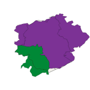
Brussels-Capital Region: Delineation of the Brussels agglomeration, in accordance with the directive 91/271/EEC concerning urban waste water treatment. The agglomeration is there defined as "an area where the population and/or economic activities are sufficiently concentrated for urban waste water to be collected and conducted to an urban waste water treatment plant or to a final discharge point". It corresponds to the two collecting basins of the waste water treatment plants of Brussels-North and Brussels-South.
-
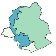
Brussels-Capital Region: A supply zone is a geographically defined area within which water intended for human consumption comes from one or more sources and within which water quality may be considered as being approximately uniform.
-
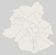
Brussels-Capital Region : location of Brussels drinking water catchment drainage gallery operated by VIVAQUA. Each section of the drainage gallery is named. Classified as protection area 1 of water extraction (with the extraction wells).
-
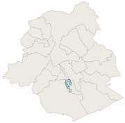
Brussels-Capital Region: localization of the extraction wells for drinking water in Brussels, run by VIVAQUA. Ranked as protected area 1 of the water extractions (with the drainage gallery)
-
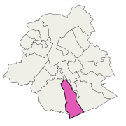
Brussels-Capital Region: The nitrate-vulnerable zone is a protected area against the pollution of groundwaters caused by nitrates from agricultural sources. It was designated in accordance with the prescriptions of the European Directive 91/676/EEC, by the Ministerial Order of 25 May 1999.
-

Brussels-Capital Region: The sensitive area to eutrophication is a protected area against the pollution of surface waters caused by waste water. This area matches the Senne river basin. In this area, urban waste water has to be collected and are subject to a stringent treatment before their discharge. It was designated in accordance with the prescriptions of the European Directive 91/271/EEC, by the Regional Decree of 23 March 1994.
 Geobru catalogue