 Geobru catalogue
Protected sites
Type of resources
Available actions
Topics
INSPIRE themes
Keywords
Contact for the resource
Provided by
Years
Formats
Representation types
Update frequencies
status
Service types
Scale
-
Brussels-Capital Region : OGC:GML Download service Urban for patrimonial protected sites
-
Brussels-Capital Region : OGC:WMS service Urban for patrimonial protected sites
-
This service allows you to view Brussels Environment datasets relating to the theme ‘Protected sites', in accordance with the technical specifications of the INSPIRE directive.
-
These map layers provide a detailed representation of archaeological sites from prehistory to the 18th century and enable efficient management of regional preventive archaeology. Archaeological Atlas : These map layers list archaeological sites and discoveries as well as an expansion zone of human settlements around the main remains. Archaeological and Historical Inventory : These map layers present the thematic inventory of a series of sites confirmed by archaeology and historical sources (monasteries, monastic refuges, breweries, cellars…).
-
This layer shows the locations of monuments, ensembles, trees, and sites listed in legal inventories.
-
These various map layers are essential for the effective management of cultural heritage (real estate) in the Brussels-Capital region. They enable authorities and stakeholders to monitor, protect, and promote this valuable cultural legacy. Protected Properties: This map layer displays the locations of cultural properties that are officially protected by the relevant authorities. Protection Zones: This map layer shows the designated protection zones around the protected properties.
-
This service allows downloading the datasets (compliant with the data specifications of INSPIRE) from the INSPIRE theme "Protected sites" of the Brussels-Capital Region of Brussels Environment.
-
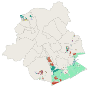
This dataset corresponds to the protected sites and natural habitats, in accordance with the ordinance of 1 March 2012 on nature conservation in the Brussels-Capital Region. It is made of six geometric classes : the protected areas in the Sonian Forest, the nature and forest reserves, Natura 2000 sites, the impact zone around Natura 2000 sites,
-
The indicative inventory of natural heritage: these various cartographic layers are essential for a comprehensive understanding of natural heritage, allowing authorities and stakeholders to monitor, protect, and promote trees and sites with heritage value (gardens, squares, parks, woods) in the region. The inventory of architectural heritage. The archaeological and historical inventory of the Brussels Region: this group of cartographic layers presents a detailed thematic inventory of archaeological and historical sites in the center of Brussels (Pentagon).
-
This download service allows, by means of a formatted URL, to download any object of the vectorial datasets from the heritage inventories in the Brussels-Capital Region.