 Geobru catalogue
Area management/restriction/regulation zones and reporting units
Type of resources
Available actions
Topics
INSPIRE themes
Keywords
Contact for the resource
Provided by
Years
Formats
Representation types
Update frequencies
status
Service types
Scale
-
Brussels-Capital Region: This service allows downloading the datasets (compliant with the data specifications of INSPIRE) "Area management/restriction/regulation zones and reporting units" of the Brussels-Capital Region of Brussels Environment.
-
This WMS service allows to display Brussels Environment datasets that comply with INSPIRE data specifications relating to INSPIRE theme 'Area management/restriction/regulation zones and reporting units'.
-
This dataset corresponds to electrowave measurement points in the Brussels-Capital Region. It is made of one geometric class.
-
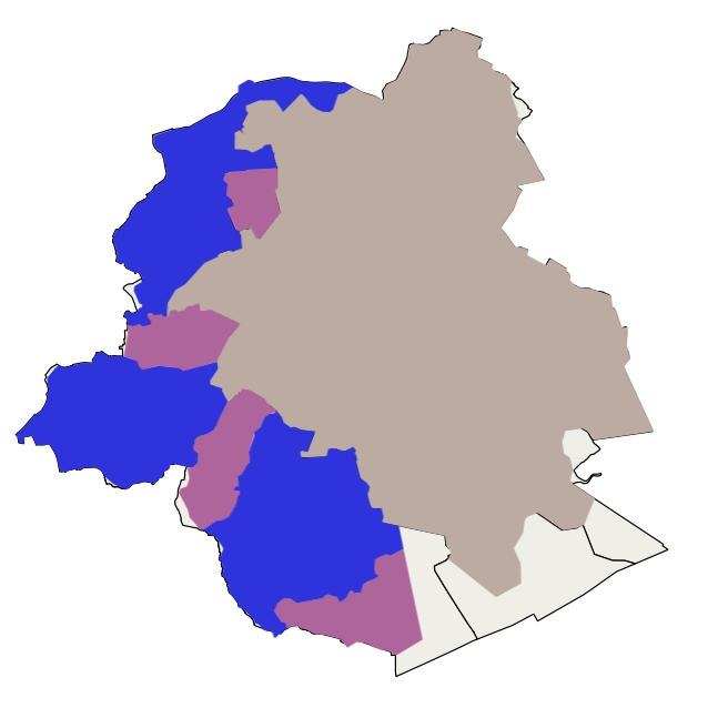
This dataset corresponds to drinking water supply zones in the Brussels-Capital Region from 2020 to 2024, in accordance with Directive 2020/2184 on the quality of water intended for human consumption. It is made up of one geometric class: drinking water supply zones.
-

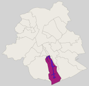
This dataset corresponds to the groundwater catchments protection areas in the Brussels-Capital Region, in accordance with the decree of the Brussels-Capital Region Government of 19 September 2002 delimiting a groundwater catchments protection area in the Bois de la Cambre and the Forêt de Soignes. It is made of one geometric class: groundwater catchments protection areas.
-
This dataset corresponds to the register of the quantities of sewage sludge produced and the quantities of sludge delivered for use in agriculture. It complies with Article 10 of Council Directive 86/278/EEC of 12 June 1986 on the protection of the environment, and in particular of the soil, when sewage sludge is used in agriculture, and covers the Brussels-Capital Region.
-
Brussels-Capital Region : groundwater catchment sites protection area 3 (i.e. extraction wells and drainage gallery) in the Brussels-Capital Region. Those site was defined in the Brussels-Capital Government decree of 19 September 2002 delimiting a groundwater catchments protection area at the “Bois de la Cambre” and in the Sonian Forest (Belgian Monitor: June 10, 2008)
-
This dataset corresponds to the priority greening zone. It is made of one geometric classe : the priority greening zoneas defined in the Regional Plan for Sustainable Development (RPSD).
-
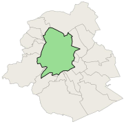
Brussels-Capital Region: location of the three aircraft noise restriction zones defined by the order of the Government of the Brussels-Capital Region of 27 May 1999 on the fight against the noise generated by air traffic.
-
This dataset corresponds to the three aircraft noise restriction zones defined by the order of the Government of the Brussels-Capital Region of 27 May 1999 on the fight against the noise generated by air traffic. It's made of one geometric clas.