 Geobru catalogue
2019
Type of resources
Available actions
Topics
INSPIRE themes
Provided by
Years
Formats
Representation types
Update frequencies
status
Service types
Scale
Resolution
-
This service allows downloading Brussels Mobility datasets.
-
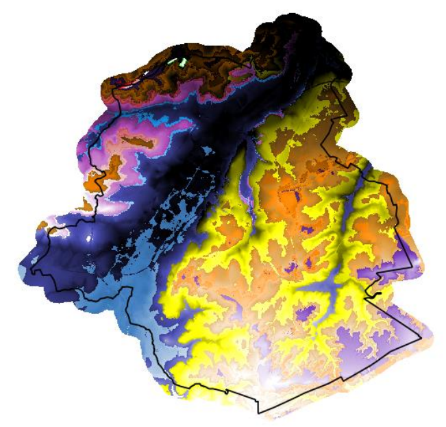
Brussels-Capital Region : The geological model BRUSTRATI3D v1.1 is a set of raster files covering the Brussels-Capital Region. These files contain the roof elevations and the thicknesses of the Stratigraphic Units (SU/BCR) and the Digital Terrain Model (DTM) of the topographic surface used in this model. These rasters have a 10x10m resolution and their reference coordinate system is EPSG 31370 (Belgian Lambert 31370). The documentation relating to the construction oh these data is available at the following addresses (French only): BRUSTRATI3D v1.1 https://document.environnement.brussels/opac_css/index.php?lvl=notice_display&id=10965 BRUSTRATI3D v1.0 https://document.environnement.brussels/opac_css/index.php?lvl=notice_display&id=10964 As the data in this archive is model-based, it may contain errors, inaccuracies and gaps. They should be used with caution and critical thinking. They can in no way replace a field study carried out by an expert. In general, Brussels Environment and the Geological Survey of Belgium cannot, under any circumstances, be held responsible for any damage, direct or indirect, resulting from the use of these data or the impossibility of using them for any reason whatsoever.
-

This dataset includes the RGB (Red, Green, Blue) orthophotos created in 2019. The images cover the entire Brussels Capital Region, with a resolution of 5 centimeters.
-
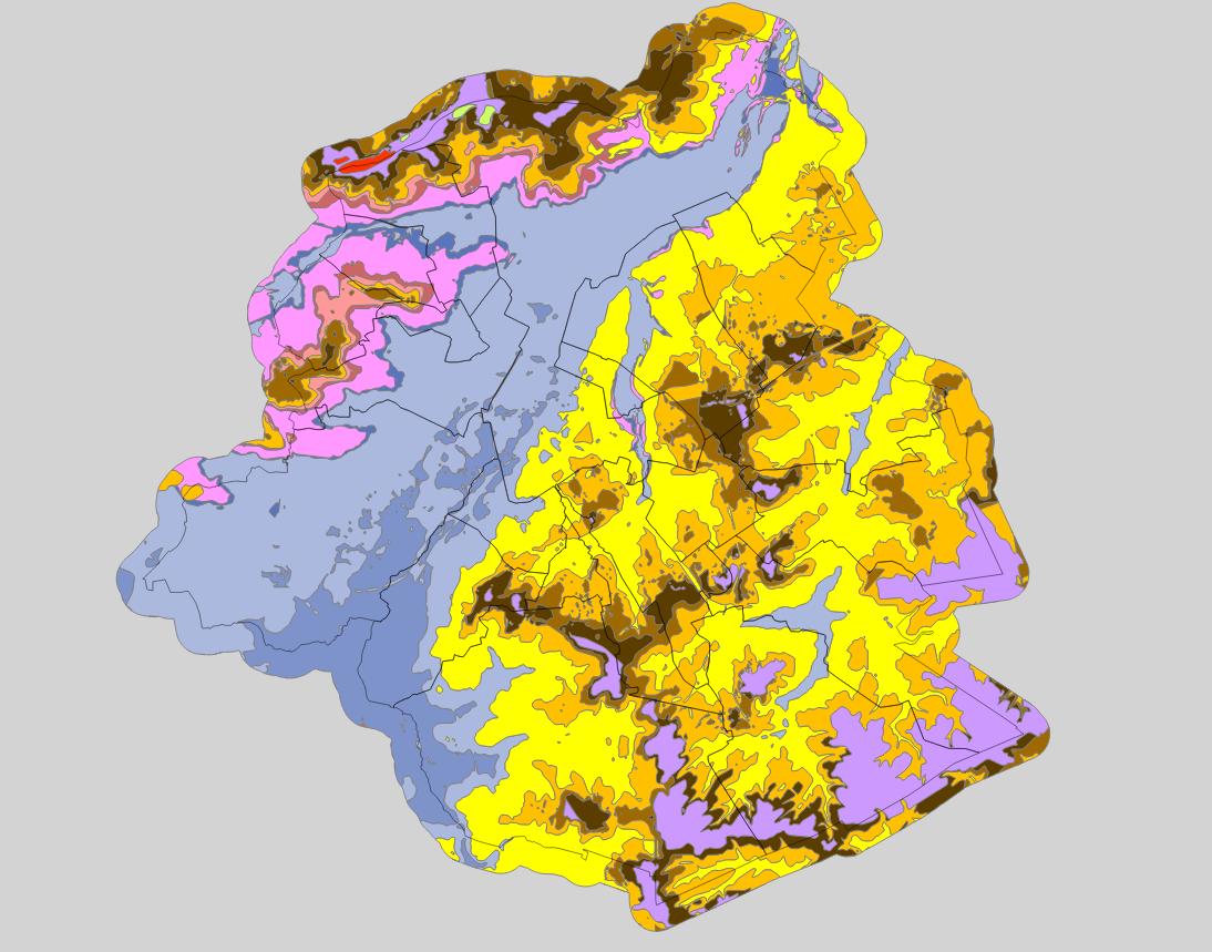
Brussels-Capital Region: spatial extents outcropping under the quaternary units of the Stratigraphic Units of the Brussels-Capital Region (SU/BCR). This data is limited to the Brussels-Capital Region’s border extended with a 500 m buffer zone. The hydrogeological unit (HU/BCR) of each SU/BRC is indicated in the attribute data. These spatial extents were extracted from the BruStrati3D v1.1 geological model. This data is generated from models and may contain errors, inaccuracies and gaps. It has informative value and may under no circumstances replace a study carried out by an expert. Bruxelles Environnement cannot be held liable for the consequences of the use of this information.
-
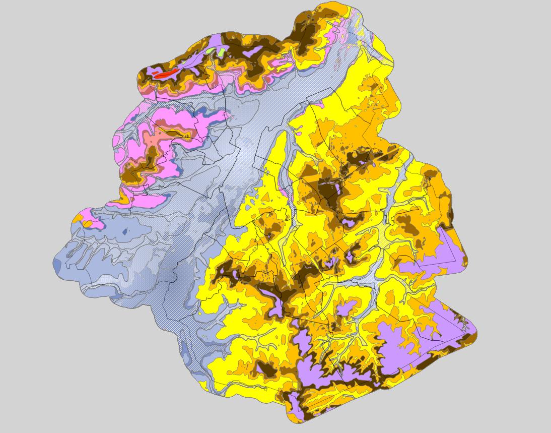
Brussels-Capital Region : spatial extents of the stratigraphic units (SU/BCR), SU/BCR_011 Backfill and SU/BCR_12 Silts cover excepted. This data is limited to the Brussels-Capital Region’s border extended with a 500 m buffer zone. The hydrogeological unit (HU/BCR) of each SU/BRC is indicated in the attribute data. These spatial extents were extracted from the BruStrati3D v1.1 geological model, except for the extensions of the quaternary units which were extracted from the Databank Ondergrond Vlaanderen database. This data is generated from models and may contain errors, inaccuracies and gaps. It has informative value and may under no circumstances replace a study carried out by an expert. Bruxelles Environnement cannot be held liable for the consequences of the use of this information.
-
This dataset includes the RGB (Red, Green, Blue) orthophotos created in 2019. The images cover the entire Brussels Capital Region, with a resolution of 5 centimeters.
-
Brussels-Capital Region: map of areas likely to be flooded (future events). Prepared in accordance with Article 4 of the European Flood Directive 2007/60/EC.
-
Brussels-Capital Region: Map of the areas affected by historical flooding (past events). Prepared in accordance with Article 4 of the European Flood Directive 2007/60/EC.
-
This service allows you to download Brussels Environment datasets relating to the theme ‘Utility and governmental services', in accordance with the technical specifications of the INSPIRE directive.
-
Brussels-Capital Region: Map indicating the entire Brussels-Capital Region for which a potentially significant flood risk exists or can be expected in the future. Prepared in accordance with Article 5 of the European Flood Directive 2007/60/EC.