 Geobru catalogue
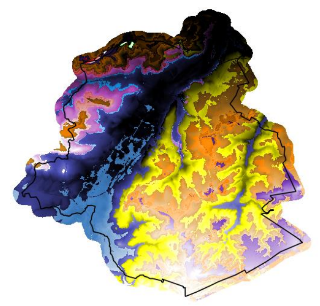
Brussels-Capital Region Geological Model - BRUSTRATI3D v1.1
Brussels-Capital Region : The geological model BRUSTRATI3D v1.1 is a set of raster files covering the Brussels-Capital Region. These files contain the roof elevations and the thicknesses of the Stratigraphic Units (SU/BCR) and the Digital Terrain Model (DTM) of the topographic surface used in this model. These rasters have a 10x10m resolution and their reference coordinate system is EPSG 31370 (Belgian Lambert 31370). The documentation relating to the construction oh these data is available at the following addresses (French only):
BRUSTRATI3D v1.1 https://document.environnement.brussels/opac_css/index.php?lvl=notice_display&id=10965
BRUSTRATI3D v1.0 https://document.environnement.brussels/opac_css/index.php?lvl=notice_display&id=10964
As the data in this archive is model-based, it may contain errors, inaccuracies and gaps. They should be used with caution and critical thinking. They can in no way replace a field study carried out by an expert. In general, Brussels Environment and the Geological Survey of Belgium cannot, under any circumstances, be held responsible for any damage, direct or indirect, resulting from the use of these data or the impossibility of using them for any reason whatsoever.
Simple
- Date (Publication)
- 2019-01-04
- Date (Revision)
- 2019-03-05
- Date (Creation)
- 2019-01-04
- Identifier
- BE.BELB / BRU_ENVI_eb0a1edf-0de3-4866-bc24-dd295a0e936f
- Status
- Completed
- Maintenance and update frequency
- Irregular
- GeoBru Administrative Regions
-
- Belgium
- Région de Bruxelles-Capitale
- Access constraints
- Other restrictions
- Other constraints
- No limitations to public access
- Use constraints
- Other restrictions
- Other constraints
- Creative Commons Attribution (CC-BY) - required citation of data source. The full license is available here: https://creativecommons.org/licenses/by/4.0/legalcode
- Spatial representation type
- Grid
- Distance
- 10 m
- Metadata language
- Français
- Topic category
-
- Geoscientific information
))
- gml32:beginPosition
- 2019-01-04
- gml32:endPosition
- 2019-01-04
- Unique resource identifier
- EPSG:31370
- Distribution format
-
-
ZIP
(
1
)
-
ZIP
(
1
)
- OnLine resource
-
Altitudes of the roofs of the Stratigraphic Units
(
WWW:DOWNLOAD-1.0-http--download
)
This zip archive contains 19 elevation rasters (.tif) of the roofs of the Stratigraphic Units of the Brussels-Capital Region (US/RBC), ranging from the Paleozoic basement (included) to the Quaternary formations. The Quaternary US/RBCs are not discretised in this dataset and only the roof elevation raster of the Quaternary hydrogeological unit (UH/RBC 01) is present (the elevation of this roof is confused with the topography). All these rasters have a resolution of 10x10 m and are in the EPSG 31370 reference coordinate system: Lambert Belge 1972. The elevation values are given in metres Second General Levelling (m-DNG).
- OnLine resource
-
Thicknesses of the Stratigraphic Units
(
WWW:DOWNLOAD-1.0-http--download
)
This zip archive contains 18 thickness rasters (.tif) of the Stratigraphic Units of the Brussels-Capital Region (US/RBC), ranging from the Palaeozoic basement (excluded) to the Quaternary formations. The Quaternary US/RBCs are not discretised in this dataset and only the total thickness raster of the Quaternary hydrogeological unit (UH/RBC 01) is present. All these rasters have a resolution of 10x10 m and are in the EPSG 31370 reference coordinate system: Lambert Belge 1972. Depth values are given in metres (m) from the topographic surface.
- OnLine resource
-
Digital Terrain Model (DTM)
(
WWW:DOWNLOAD-1.0-http--download
)
Digital Terrain Model (raster) of the BRUSTRATI3D V1.1 stratigraphic model. This raster covering the whole of the Brussels-Capital Region has a resolution of 10x10 m and has as reference coordinate system: EPSG 31370 Lambert Belge 1972. The elevation values are given in metres Second General Levelling (m-DNG). The construction of this raster required the use of data from Brussels Urbis: https://paradigm.brussels/en/our-services/smart-admin/enhance-regional-data/urbis-data/urbis-data
- Hierarchy level
- Dataset
Conformance result
- Date (Publication)
- 2010-12-08
- Explanation
- The dataset does not fullfill the minimal requirements
- Pass
- No
- Statement
- Brussels Environment and the Geological Survey of Belgium
- File identifier
- eb0a1edf-0de3-4866-bc24-dd295a0e936f XML
- Metadata language
- Français
- Character set
- UTF8
- Hierarchy level
- Dataset
- Date stamp
- 2025-12-09T17:24:07
- Metadata standard name
- ISO19115
- Metadata standard version
- 2003/Cor.1:2006
Overviews
Spatial extent
Provided by
