urban planning and development
Type of resources
Available actions
Topics
Keywords
Contact for the resource
Provided by
Formats
Representation types
Update frequencies
Scale
-

This dataset corresponds to the sites and trees managed by Brussels Environment. It is made of two geometric classes : trees managed by Brussels Environment, and sites managed by Brussels Environment.
-

This dataset corresponds to the areas with a lack of green spaces accessible to the public in the Brussels-Capital Region, in accordance with the objectives of the Regional Nature Plan 2016-2024. It is made of one geometric classes : Areas with a lack of green spaces accessible to the public
-

This dataset corresponds to the landscapes influences, as part of Brussels Environment's City-Nature initiative. It is made of one geometric classe : landscape influences.
-

This dataset corresponds to the publicly accessible green spaces. It is made of one geometric classes : publicly accessible green spaces.
-

This dataset corresponds to the priority greening zone. It is made of one geometric classe : the priority greening zoneas defined in the Regional Plan for Sustainable Development (RPSD).
-

This dataset corresponds the biological evaluation. It is made of four geometric classes : biotopes, roads of biological interest, the typology of regional green spaces with an indication of their biological value, and urban blocs categorised according to the presence of biotopes of high biological value, the level of vegetation and the openness of the built-up frontages to facilitate wildlife mobility,
-

This dataset corresponds to Brussels ecological network, as defined by the nature ordinance of 1 March 2012 and mapped in the Nature Plan. It is made of one geometric classe : the Brussels ccological network, a typology of regional green spaces according to their ecological importance.
-
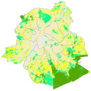
This dataset corresponds to the vegetation cover in the Brussels Capital Region. It is made of three geometric classes : vegetation 2016, vegetation 2020, and vegetation 2021.
 Geobru catalogue