 Geobru catalogue
water resource
Type of resources
Available actions
Topics
INSPIRE themes
Keywords
Contact for the resource
Provided by
Years
Formats
Representation types
Update frequencies
status
Scale
-
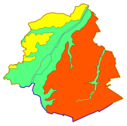
Brussels-Capital Region : data on the 5 Groundwaterbody of the Area of Brussels, defined under the Directive and the Ordinance Water : code European, code of Brussels and name of the water mass, hydrographic district
-

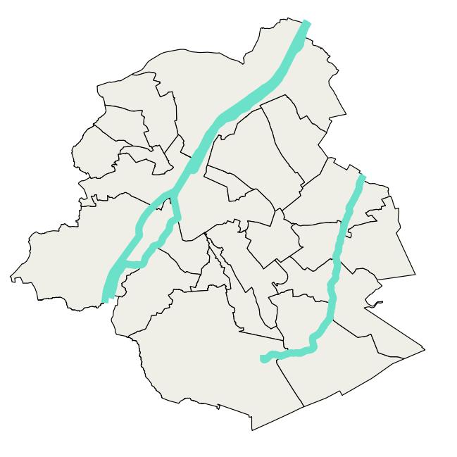
Brussels-Capital Region : watercrouses in Brussels Region, defined under the Directive and the Ordinance Water
-

This dataset corresponds to the groundwaterbodies in the Brussels-Capital Region, in accordance with Directive 2000/60/EC of the European Parliament and of the Council of 23 October 2000 establishing a framework for Community action in the field of water policy (Water Framework Directive). It is made up of one geometric class: groundwaterbodies.
-

Brussels-Capital Region : watercrouse links in Brussels Region, defined under the Directive and the Ordinance Water
-
Brussels-Capital Region : data on the 3 Surface Water Bodies of the Area of Brussels, defined under the Directive and the Ordinance Water
-

Brussels-Capital Region : drainage basins in Brussels Region, defined under the Directive and the Ordinance Water
-

Brussels-Capital Region : standing Water in Brussels Region, defined under the Directive and the Ordinance Water
-
The dataset covers concentrations of pollutants subject to quality standard, pollutants posing a risk for environment and health, other pollutant and pollutant indicators mesured in groundwater characterised in the Frame Water Directive (2000/60/EC). The dataset also includes assessment of chemical status of groundwater and the identification and reversal of significant and sustained trends.
-
The dataset correponds to the nitrate content of raw groundwater intended for human consumption, monitored by Brussels Environment and supplemented by operators of drinkable groundwater abstraction points located in the nitrate-vulnerable zone delimited by DGBCR on 25 may 1999.
-
This dataset is based on measurements and inspections carried out by the scientific experts at Brussels Environment and presents the results of their investigations into all issues related to the evolution of water in the Brussels-Capital Region. In addition, the Bruwater application provided by Brussels Environment allows users to consult data on surface water and groundwater in the Brussels-Capital Region.