 Geobru catalogue
groundwater pollution
Type of resources
Available actions
Topics
INSPIRE themes
Keywords
Contact for the resource
Provided by
Years
Formats
Representation types
Update frequencies
status
Scale
-
This dataset corresponds to the nitrate-vulnerable zone in accordance with the prescriptions of the European Directive 91/676/EEC, by the Ministerial Order of 25 May 1999. It is made of one geometric classe : the nitrate-vulnerable zone.
-
Brussels-Capital Region: Monitoring network of the nitrate content in surface waters and groundwater. It was designated in accordance with the prescriptions of the European Directive 91/676/EEC concerning the protection of waters against pollution caused by nitrates from agricultural sources, by the Ministerial Order of 25 May 1999.
-

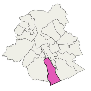
Brussels-Capital Region: The nitrate-vulnerable zone is a protected area against the pollution of groundwaters caused by nitrates from agricultural sources. It was designated in accordance with the prescriptions of the European Directive 91/676/EEC, by the Ministerial Order of 25 May 1999.
-
The dataset covers concentrations of pollutants subject to quality standard, pollutants posing a risk for environment and health, other pollutant and pollutant indicators mesured in groundwater characterised in the Frame Water Directive (2000/60/EC). The dataset also includes assessment of chemical status of groundwater and the identification and reversal of significant and sustained trends.
-
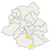
The dataset correponds to the nitrate content of raw groundwater intended for human consumption, monitored by Brussels Environment and supplemented by operators of drinkable groundwater abstraction points located in the nitrate-vulnerable zone delimited by DGBCR on 25 may 1999.
-
This dataset is based on measurements and inspections carried out by the scientific experts at Brussels Environment and presents the results of their investigations into all issues related to the evolution of water in the Brussels-Capital Region. In addition, the Bruwater application provided by Brussels Environment allows users to consult data on surface water and groundwater in the Brussels-Capital Region.