 Geobru catalogue
Geology
Type of resources
Available actions
Topics
INSPIRE themes
Keywords
Contact for the resource
Provided by
Years
Formats
Representation types
Update frequencies
Service types
Scale
-
This service allows you to download Brussels Environment datasets relating to the theme ‘Geology’, in accordance with the technical specifications of the INSPIRE directive.
-
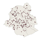
This dataset corresponds to geothermal installations in the Brussels-Capital Region. It is made of one geometric class.
-
This WMS service allows to display Brussels Environment datasets that comply with INSPIRE data specifications relating to INSPIRE theme 'Geology'.
-
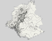
This dataset corresponds to the stratigraphic units in the Brussels-Capital Region. It is made of four geometric classes: geological field data, extensions of stratigraphic units, geological map of the Brussels Region, elevations of the tops of the stratigraphic units, and thicknesses of the stratigraphic units.
-
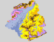
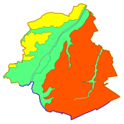
Brussels-Capital Region: spatial extents outcropping under the quaternary units of the Stratigraphic Units of the Brussels-Capital Region (SU/BCR). This data is limited to the Brussels-Capital Region’s border extended with a 500 m buffer zone. The hydrogeological unit (HU/BCR) of each SU/BRC is indicated in the attribute data. These spatial extents were extracted from the BruStrati3D v1.1 geological model. This data is generated from models and may contain errors, inaccuracies and gaps. It has informative value and may under no circumstances replace a study carried out by an expert. Bruxelles Environnement cannot be held liable for the consequences of the use of this information.
-

This dataset corresponds to the piezometry of the phreatic system in the Brussels-Capital Region. It is made of four geometric classes: piezometric levels in the Brussels phreatic system, phreatic level heights, phreatic level depths, and phreatic level depths (HD).
-
Brussels-Capital Region : data on the 5 Groundwaterbody of the Area of Brussels, defined under the Directive and the Ordinance Water : code European, code of Brussels and name of the water mass, hydrographic district
-

This dataset corresponds to the groundwaterbodies in the Brussels-Capital Region, in accordance with Directive 2000/60/EC of the European Parliament and of the Council of 23 October 2000 establishing a framework for Community action in the field of water policy (Water Framework Directive). It is made up of one geometric class: groundwaterbodies.
-
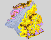
Brussels-Capital Region : spatial extents of the stratigraphic units (SU/BCR), SU/BCR_011 Backfill and SU/BCR_12 Silts cover excepted. This data is limited to the Brussels-Capital Region’s border extended with a 500 m buffer zone. The hydrogeological unit (HU/BCR) of each SU/BRC is indicated in the attribute data. These spatial extents were extracted from the BruStrati3D v1.1 geological model, except for the extensions of the quaternary units which were extracted from the Databank Ondergrond Vlaanderen database. This data is generated from models and may contain errors, inaccuracies and gaps. It has informative value and may under no circumstances replace a study carried out by an expert. Bruxelles Environnement cannot be held liable for the consequences of the use of this information.
-
This dataset corresponds to authorized groundwater catchments in the Brussels-Capital Region. It is made up of one geometric class: groundwater catchments.