Natural risk zones
Type of resources
Available actions
Topics
INSPIRE themes
Keywords
Contact for the resource
Provided by
Formats
Representation types
Update frequencies
Service types
-
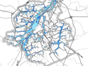
Brussels-Capital Region: This service is the service mapping data visualization of the dataset of Brussels Environment (compliant with the data specifications of INSPIRE) "Flood hazard 2019" of the Brussels-Capital Region of Brussels Environment.
-
Brussels-Capital Region: This service allows downloading the dataset (compliant with the data specifications of INSPIRE) "Exposed elements" of the Brussels-Capital Region of Brussels Environment.
-
Brussels-Capital Region: This service allows downloading the dataset (compliant with the data specifications of INSPIRE) "Flood hazard 2019" of the Brussels-Capital Region of Brussels Environment.
-
Brussels-Capital Region: This service allows downloading the dataset (compliant with the data specifications of INSPIRE) "Preliminary Flood Risk Assessment for Past Events" of the Brussels-Capital Region of Brussels Environment.
-
Brussels-Capital Region: This service is the service mapping data visualization of the dataset of Brussels Environment (compliant with the data specifications of INSPIRE) "Preliminary Flood Risk Assessment for Past Events" of the Brussels-Capital Region of Brussels Environment.
-
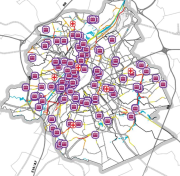
Brussels-Capital Region: This service is the service mapping data visualization of the dataset of Brussels Environment (compliant with the data specifications of INSPIRE) "Exposed elements" of the Brussels-Capital Region of Brussels Environment.
-

Brussels-Capital Region : location of the different surface water quality monitoring sites under the Water Framework Ordonnance and Directive. Surface waters concerned are surface water bodies: Canal, Senne and Woluwe. Monitoring involves a series of chemical, physico-chemical parameters... The code and the name of the monitoring site are given.
-

Brussels-Capital Region: Map of the areas affected by historical flooding (past events). Prepared in accordance with Article 4 of the European Flood Directive 2007/60/EC.
-

Brussels-Capital Region : This map depicts elements exposed to potential flooding.
 Geobru catalogue