 Geobru catalogue
Area management/restriction/regulation zones and reporting units
Type of resources
Available actions
Topics
INSPIRE themes
Keywords
Contact for the resource
Provided by
Years
Formats
Representation types
Update frequencies
status
Service types
Scale
-
Brussels-Capital Region: This service allows downloading the datasets (compliant with the data specifications of INSPIRE) "Area management/restriction/regulation zones and reporting units" of the Brussels-Capital Region of Brussels Environment.
-
This WMS service allows to display Brussels Environment datasets that comply with INSPIRE data specifications relating to INSPIRE theme 'Area management/restriction/regulation zones and reporting units'.
-
Brussels-Capital Region : groundwater catchment sites protection area 3 (i.e. extraction wells and drainage gallery) in the Brussels-Capital Region. Those site was defined in the Brussels-Capital Government decree of 19 September 2002 delimiting a groundwater catchments protection area at the “Bois de la Cambre” and in the Sonian Forest (Belgian Monitor: June 10, 2008)
-
Brussels-Capital Region: location of the three aircraft noise restriction zones defined by the order of the Government of the Brussels-Capital Region of 27 May 1999 on the fight against the noise generated by air traffic.
-
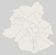
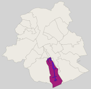
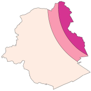
Brussels-Capital Region : location of Brussels drinking water catchment drainage gallery operated by VIVAQUA. Each section of the drainage gallery is named. Classified as protection area 1 of water extraction (with the extraction wells).
-
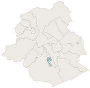
Brussels-Capital Region: localization of the extraction wells for drinking water in Brussels, run by VIVAQUA. Ranked as protected area 1 of the water extractions (with the drainage gallery)
-
Brussels-Capital Region: Delineation of the Brussels agglomeration, in accordance with the directive 91/271/EEC concerning urban waste water treatment. The agglomeration is there defined as "an area where the population and/or economic activities are sufficiently concentrated for urban waste water to be collected and conducted to an urban waste water treatment plant or to a final discharge point". It corresponds to the two collecting basins of the waste water treatment plants of Brussels-North and Brussels-South.
-

Brussels-Capital Region: Drinking water supply zones, in accordance with Directive 2020/2184 on the quality of water intended for human consumption. A supply zone is a geographically defined area within which water intended for human consumption comes from one or more sources and within which water quality may be considered as being approximately uniform.
-
Brussels-Capital Region: The nitrate-vulnerable zone is a protected area against the pollution of groundwaters caused by nitrates from agricultural sources. It was designated in accordance with the prescriptions of the European Directive 91/676/EEC, by the Ministerial Order of 25 May 1999.
-
This discovery service allows, by means of a formatted URL, to access the metadata covered by the INSPIRE Directive, in accordance with Implementing Decision 2019/1372.