 Geobru catalogue
environment
Type of resources
Available actions
Topics
INSPIRE themes
Keywords
Contact for the resource
Provided by
Formats
Representation types
Update frequencies
status
Scale
-
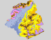
Brussels-Capital Region: spatial extents outcropping under the quaternary units of the Stratigraphic Units of the Brussels-Capital Region (SU/BCR). This data is limited to the Brussels-Capital Region’s border extended with a 500 m buffer zone. The hydrogeological unit (HU/BCR) of each SU/BRC is indicated in the attribute data. These spatial extents were extracted from the BruStrati3D v1.1 geological model. This data is generated from models and may contain errors, inaccuracies and gaps. It has informative value and may under no circumstances replace a study carried out by an expert. Bruxelles Environnement cannot be held liable for the consequences of the use of this information.
-
Brussels-Capital Region : data on the 5 Groundwaterbody of the Area of Brussels, defined under the Directive and the Ordinance Water : code European, code of Brussels and name of the water mass, hydrographic district
-
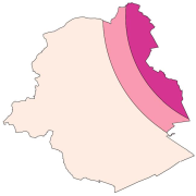
Brussels-Capital Region: location of the three aircraft noise restriction zones defined by the order of the Government of the Brussels-Capital Region of 27 May 1999 on the fight against the noise generated by air traffic.
-
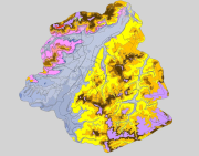
Brussels-Capital Region : spatial extents of the stratigraphic units (SU/BCR), SU/BCR_011 Backfill and SU/BCR_12 Silts cover excepted. This data is limited to the Brussels-Capital Region’s border extended with a 500 m buffer zone. The hydrogeological unit (HU/BCR) of each SU/BRC is indicated in the attribute data. These spatial extents were extracted from the BruStrati3D v1.1 geological model, except for the extensions of the quaternary units which were extracted from the Databank Ondergrond Vlaanderen database. This data is generated from models and may contain errors, inaccuracies and gaps. It has informative value and may under no circumstances replace a study carried out by an expert. Bruxelles Environnement cannot be held liable for the consequences of the use of this information.
-
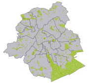
Brussels-Capital Region : database of green spaces and recreational areas in the Brussels-Capital Region, accessible to the public
-
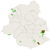
Brussels-Capital Region : data on the nature and forest reserves in the Brussels-Capital Region . Official name of the reserve; date of the legal act identifying the reserve; type of reserve
-
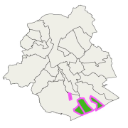
Brussels-Capital Region : Sonian Forest protection area : vulnerable planting or regeneration plots, refuges for wildlife, fragile being recolonized areas. In those areas, walkers must always stay on the paths and dogs must be leashed (Order of 30 March 1995).
-
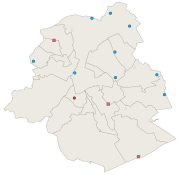
Brussels-Capital Region: location of various monitoring stations sound levels, managed by Brussels Environment. The monitoring stations are dedicated to ambient noise, road, rail and/or air. Indication of the name (corresponding to the location) and the dominant sound source. Measurement results are available via the module WebNoise on the website of Brussels Environment.
-
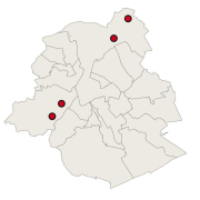
Brussels-Capital Region : this directive has as an aim the prevention of the major accidents implying of dangerous substances and the limitation of their consequences for the man and the environment, in order to ensure in a coherent and effective way in all the country of the high levels of protection. The geographical data file SEVESO consists of several classes of objects which make it possible to locate all the SEVESO sites on the territory of the area of Brussels.
-
Brussels-Capital Region : This map depicts elements exposed to potential flooding.