 Geobru catalogue
Transport networks
Type of resources
Available actions
Topics
INSPIRE themes
Keywords
Contact for the resource
Provided by
Years
Formats
Representation types
Update frequencies
Service types
Scale
-
This service allows downloading Brussels Mobility datasets.
-
Web Map Service for layers of Brussels Mobility
-
This view service allows, via a formatted URL, to display all the INSPIRE vector datasets managed by Paradigm in the Brussels-Capital Region.
-
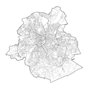
This dataset contains data on the road transport network in the Brussels-Capital Region. The SA object corresponds to the centerlines of street segments in the Region.
-
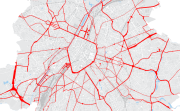
Brussels-Capital Region : The road network in the Brussels-Capital Region is divided in regional (generally the most structuring traffic axes) and municipal (generally roads of local character) roads. Approximately 20% of the road network is managed by the region.
-

This dataset corresponds to routes and stops of the STIB/MIVB Network (Tramway-Metro).
-

This dataset corresponds to the routes and stops of the STIB/MIVB network (Bus).
-
This discovery service allows, by means of a formatted URL, to access the metadata covered by the INSPIRE Directive, in accordance with Implementing Decision 2019/1372.