UrbIS - 3D Constructions
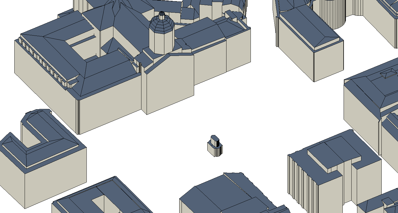
The UrbIS - Constructions 3D product corresponds to the dataset of three-dimensionally modeled buildings located in the Brussels Region. It includes both buildings and engineering structures. It comprises five classes: (1) the first corresponds to three-dimensional buildings; (2) the second to buildings' faces; (3) the third to three-dimensional engineering structures; and finally, (4) the fourth to engineering structures' faces.
The dataset is freely downloadable as a zipped file. The first and third classes of this dataset are not supported by the GeoPackage format.
Simple
- Date (Creation)
- 2024-02-01
- Date (Revision)
- 2024-12-16
- Identifier
- CIRB-CIBG / e9ed151b-cffd-11ee-8503-00090ffe0001
- Status
- Completed
- Maintenance and update frequency
- Monthly
- Access constraints
- Other restrictions
- Other constraints
- No limitations to public access
- Use constraints
- Other restrictions
- Spatial representation type
- Vector
- Denominator
- 500
- Metadata language
- Nederlands; Vlaams
- Metadata language
- Français
- Character set
- UTF8
- Topic category
-
- Structure
- Description
- Brussels-Capital Region
))
- Unique resource identifier
- EPSG:31370
- Codespace
- EPSG
- Distribution format
-
-
Esri Shapefile
(
10.2
)
-
SketchUp
()
-
Autocad DWG
()
-
GeoPackage
()
-
Esri Shapefile
(
10.2
)
- OnLine resource
- https://datastore.brussels/web/urbis-download ( WWW:DOWNLOAD-1.0-http--download )
- OnLine resource
- https://urbisdownload.datastore.brussels/atomfeed/e9ec2aa4-cffd-11ee-bccc-00090ffe0001-en.xml ( ATOM )
- OnLine resource
- https://datastore.brussels/web/urbis-download ( WWW:DOWNLOAD-1.0-http--download )
- Hierarchy level
- Dataset
Conformance result
- Date (Publication)
- 2024-02-01
- Pass
- Yes
- Statement
- This dataset is produced and updated by photogrammetry, using aerial photos taken during a flyover of the area, and with the aid of plans. Three-dimensional buildings and structures are individually modeled with a level of detail equivalent to LoD 2 (Level of Detail 2), as defined in the CityGML (City Geography Markup Language - Version 1) exchange standard.
- File identifier
- e9ec2aa4-cffd-11ee-bccc-00090ffe0001 XML
- Metadata language
- English
- Character set
- UTF8
- Parent identifier
- UrbIS - Vector f3ad5174-4a86-11ef-b009-010101010000
- Hierarchy level
- Dataset
- Date stamp
- 2024-10-11T08:06:27
- Metadata standard name
- Brussels INSPIRE metadata profil
Overviews

Spatial extent
))
Provided by

 Geobru catalogue