 Geobru catalogue
UrbIS - Administrative units
UrbIS – Unités administratives
UrbIS - Administratieve eenheden
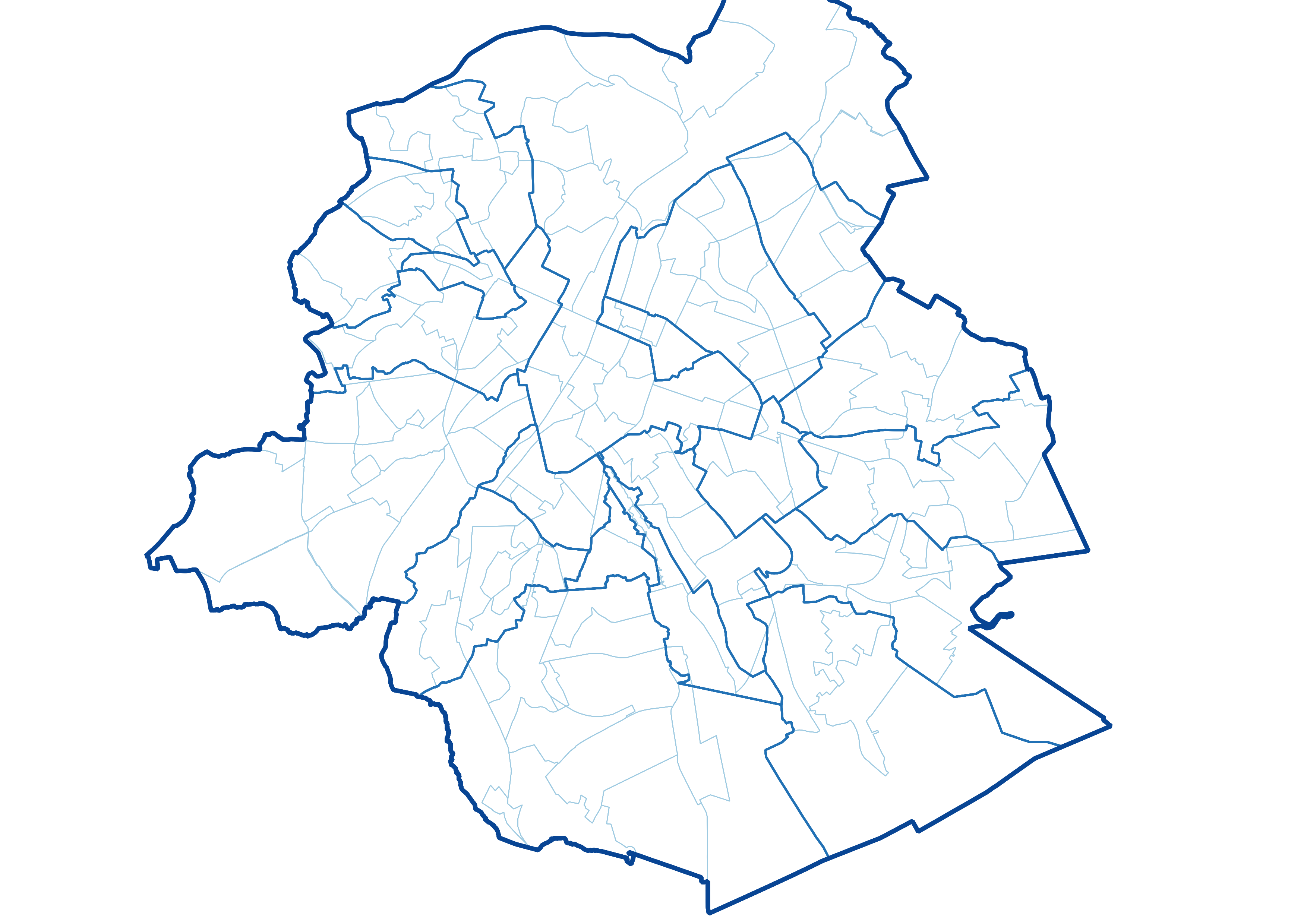
UrbIS - Administrative Units is the Brussels Region administrative and statistical units dataset. This dataset is made up of six different geometric classes. The first class is the territory of the Brussels Region. The second is the territory of the nineteen municipalities that make up the Region, the third is the six police zones in the Region, the fourth is the monitoring districts, the fifth is the statistical sectors.
The dataset is freely downloadable as a zipped shapefile. The dataset is produced by integrating data from FPS Finance and FPS Economy. Their respective licences apply to the classes deriving from them.
UrbIS – Unités administratives correspond au jeu de données des unités administratives et statistiques en Région bruxelloise. Ce jeu de données est composé de six classes géométriques. La première classe correspond à au territoire de la Région bruxelloise. La deuxième correspond au territoire des dix-neuf communes qui composent la Région, la troisième correspond aux six zones de polices comprises dans la Région, la quatrième correspond aux quartiers du monitoring, la cinquième correspond aux secteurs statistiques.
Le jeu de données est librement téléchargeable, sous forme de shapefiles zippés. Le jeu de données est notamment produit par intégration des données du SPF Finances et du SPF Economie. Leurs licences respectives sont d'application en ce qui concerne les classes qui en proviennent.
UrbIS - Administratieve eenheden komt overeen met de dataset van administratieve en statistische eenheden voor het Brussels Gewest. Deze dataset bestaat uit zes geometrische klassen. De eerste klasse stemt overeen met het grondgebied van het Brussels Gewest. De tweede stemt overeen met het grondgebied van de negentien gemeenten die samen het Gewest vormen, de derde met de zes politiezones binnen het Gewest, de vierde met de wijken van de monitoring, de vijfde met de statistische sectoren.
De dataset is gratis te downloaden in de vorm van gezipte shapefiles. De dataset is het resultaat van het integreren van gegevens van de FOD Financiën met deze van de FOD Economie. Hun respectieve licenties zijn van toepassing voor wat betreft de klassen die eruit voortkomen.
Simple
-
Date (Création)Datum (creatie)Date (Creation)
- 2022-12-01
-
Date (Révision)Datum (revisie)Date (Revision)
- 2026-06-05
-
IdentificateurIdentifierIdentifier
- CIRB-CIBG / f6b8f84f-6a62-11ed-91ba-010101010000
-
EtatStatusStatus
-
FinalisécompleetCompleted
-
Fréquence de mise à jourHerzieningsfrequentieMaintenance and update frequency
-
AnnuellejaarlijksAnnually
-
Contraintes d'accès(Juridische) toegangsrestrictieAccess constraints
-
Autres restrictionsandersOther restrictions
-
Other constraintsAutres contraintesOverige beperkingen
-
No limitations to public accessPas de restriction concernant l'accès publicNo limitations on public access
-
Contraintes d'utilisation(Juridische) gebruiksbeperkingUse constraints
-
Autres restrictionsandersOther restrictions
-
Other constraintsAutres contraintesOverige beperkingen
-
The SPF Finances license applies to police zones, municipalities, and the region. It is available in french (https://finances.belgium.be/sites/default/files/Licence_plan_opendata_FR.PDF) and in dutch (https://financien.belgium.be/sites/default/files/Licentie_plan_opendata_NL.PDF).
The SPF Economy license applies to statistical sectors. It is available here: https://statbel.fgov.be/sites/default/files/files/opendata/Licence%20open%20data_EN.pdf.
La licence du SPF Finances s’applique pour les zones de polices, les communes, et la région. Elle est disponible ici : https://finances.belgium.be/sites/default/files/Licence_plan_opendata_FR.PDF.
La licence du SPF Économie s’applique pour les secteurs statistiques. Elle est disponible ici : https://statbel.fgov.be/sites/default/files/files/opendata/Licence%20open%20data_FR.pdf.
De vergunning van de FOD Financiën geldt voor politie zones, gemeenten, en het gewest. Het is hier beschikbaar: https://financien.belgium.be/sites/default/files/Licentie_plan_opendata_NL.PDF.
De FOD Economie licentie is van toepassing op de statistische sectoren. Het is hier beschikbaar: https://statbel.fgov.be/sites/default/files/files/opendata/Licence%20open%20data_NL.pdf.
-
Type de représentation spatialeRuimtelijk schemaSpatial representation type
-
VecteurvectorVector
-
Dénominateur de l'échelleToepassingsschaalDenominator
- 25000
-
LangueTaalMetadata language
- English
-
LangueTaalMetadata language
- Nederlands; Vlaams
-
LangueTaalMetadata language
- Français
-
Jeu de caractèresKaraktersetCharacter set
-
Utf8utf8UTF8
-
Catégorie ISOOnderwerpTopic category
-
-
LimitesgrenzenBoundaries
-
-
DescriptionDescriptionOmschrijving
-
Brussels-Capital RegionRégion de Bruxelles-CapitaleBrussel Hoofstedelijk Gewest
))
-
Unique resource identifierCodeCode
-
EPSG:31370EPSG:31370EPSG:31370
-
Format (encodage)Distributie formaatDistribution format
-
Ressource en ligneOnLine bronnenOnLine resource
- https://geoservices-vector.irisnet.be/geoserver/urbisvector/ows?Service=WMS&Version=1.3.0&Request=GetCapabilities&Language=eng https://geoservices-vector.irisnet.be/geoserver/urbisvector/ows?Service=WMS&Version=1.3.0&Request=GetCapabilities&Language=fre https://geoservices-vector.irisnet.be/geoserver/urbisvector/ows?Service=WMS&Version=1.3.0&Request=GetCapabilities&Language=dut ( OGC Web Map Service )
-
Ressource en ligneOnLine bronnenOnLine resource
- https://geoservices-vector.irisnet.be/geoserver/urbisvector/wfs?Service=WFS&Version=2.0.0&Request=GetCapabilities&Language=eng https://geoservices-vector.irisnet.be/geoserver/urbisvector/wfs?Service=WFS&Version=2.0.0&Request=GetCapabilities&Language=fre https://geoservices-vector.irisnet.be/geoserver/urbisvector/wfs?Service=WFS&Version=2.0.0&Request=GetCapabilities&Language=dut ( OGC Web Feature Service )
-
Ressource en ligneOnLine bronnenOnLine resource
- https://urbisdownload.datastore.brussels/atomfeed/f6b83500-6a62-11ed-be6d-010101010000-en.xml https://urbisdownload.datastore.brussels/atomfeed/f6b83500-6a62-11ed-be6d-010101010000-fr.xml https://urbisdownload.datastore.brussels/atomfeed/f6b83500-6a62-11ed-be6d-010101010000-nl.xml ( ATOM Syndication Format )
-
Ressource en ligneOnLine bronnenOnLine resource
- Styles (sld) of the product Styles (sld) du produit Productstijlen (sld) ( WWW:DOWNLOAD-1.0-http--download )
-
NiveauNiveau kwaliteitsbeschrijvingHierarchy level
-
Jeu de donnéesdatasetDataset
Résultat de conformité
Resultaat conformiteit met de specificatie
Conformance result
-
Date (Publication)Datum (publicatie)Date (Publication)
- 2024-05-24
-
ExplanationExplicationUitleg
-
Degré de conformitéIndicatie van conformiteit met de specificatiePass
- Yes
-
StatementGénéralités sur la provenanceAlgemene beschrijving herkomst
-
This dataset is produced by integrating administrative geographic data managed by the General Administration of Patrimonial Documentation, Stabel and Perspective the authentic national and sources in this field. It takes into account proven errors reported by individual and institutional users.Ce jeu de données est produit par l'intégration des données géographiques à caractère administratif gérées par l'Administration Générale de la Documentation Patrimoniale, de Statbel et de Perspective, sources authentiques nationales et régionales en la matière. Il tient compte des erreurs avérées signalées par les utilisateurs particuliers et institutionnels.Deze dataset kwam tot stand door de integratie van geografische data met een administratief karakter beheerd door de Algemene Administratie van de Patrimoniumdocumentatie, Stabel en Perspective, de authentieke nationale en gewestelijke bronnen op dat vlak. Daarin werd rekening gehouden met de door particuliere en institutionele gebruikers gesignaleerde en bewezen fouten.
-
Identifiant de la ficheMetadata IDFile identifier
- f6b83500-6a62-11ed-be6d-010101010000 XML
-
LangueTaalMetadata language
- English
-
Jeu de caractèresKaraktersetCharacter set
-
Utf8utf8UTF8
- Parent identifier
- UrbIS - Vector f3ad5174-4a86-11ef-b009-010101010000
-
Type de ressourceHierarchisch niveauHierarchy level
-
Jeu de donnéesdatasetDataset
-
Date des métadonnéesMetadata datumDate stamp
- 2026-06-16T08:49:50
- Metadata standard name
- Brussels INSPIRE metadata profil
Overviews
Spatial extent
Provided by
