 Geobru catalogue
INSPIRE - Land cover
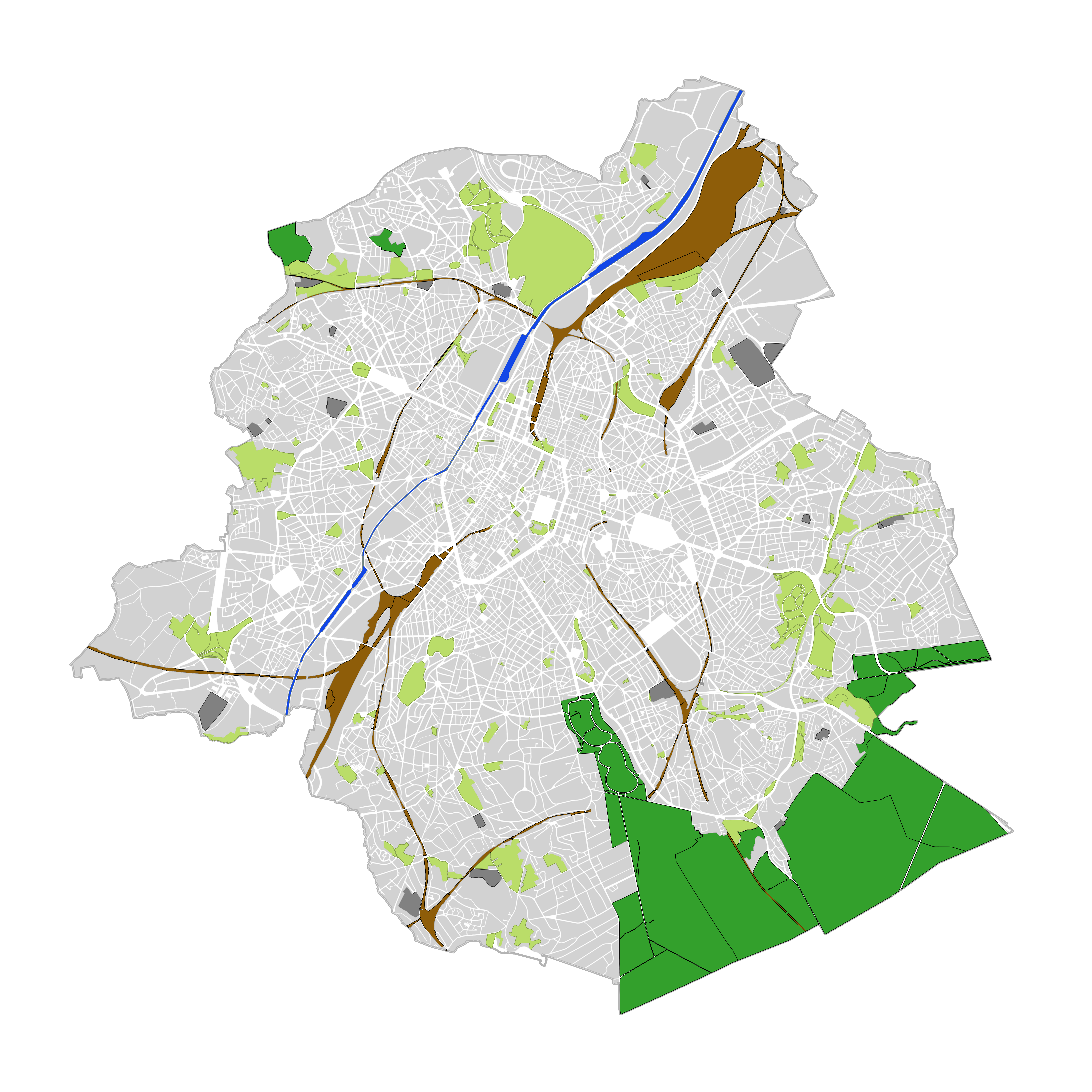
Brussels-Capital Region : land cover refers to the physical and biological cover of the earth's surface, including artificial surfaces, agricultural areas, forests, semi-natural areas, wetlands, water bodies.
The entity "Green Block" (or green area) identifies the footprint of vegetated amenity areas(lawn, trees, possibly planted with flowers and ornamental trees and bushes, and often lined ponds and paths). Green areas have been designed on the basis of various plans (photogrammetric surveys, detailed maps, maps of towns, ...). They have a heterogeneous precision because of the diversity of origin. The entity "Green Block" (or green area) is represented using three different types:
- GB-A: grassed (some grassy berm plants or trees) bands;
- GB-B: parks (water parks located in these areas are not excluded);
- GB-F: forests or wood (islets of the Soignes Forest located in the Brussels Region).
The entity "Water Block" (or water area) locates and identifies various water bodies in the territory of the Brussels-Capital Region (channel, ponds, Senne river, ...).
We distinguish :
1. water areas located at [0] which are visible from the air (abbreviated WB-0);
2. water areas (for the channel) located at [-] on the road (invisible from the sky) (abbreviated WB-M).
Simple
- Date (Creation)
- 2006-01-01T17:00:00
- Date (Revision)
- 2013-06-24T17:00:00
- Date (Publication)
- 2013-06-24T17:00:00
- Identifier
- BE.CIRB / BRU_URBIS_LC
https://be.brussels/en/about-region/structure-and-organisations/administrations-and-institutions-region/paradigm
- Maintenance and update frequency
- As needed
- GeoBru Administrative Regions
-
- Belgium
- Région de Bruxelles-Capitale
- GeoBru brussels keywords
-
- Green Network
- Layers
- Public Space
- Ecological Network
- Reporting Inspire
- GEMET - INSPIRE themes, version 1.0
-
- Land cover
- Spatial scope
-
- Regional
- INSPIRE feature concept dictionary
-
- Land Cover Grid Coverage
- Land Cover Unit
- Land Cover Data set
- Access constraints
- Other restrictions
- Other constraints
- No limitations to public access
- Use constraints
- Other restrictions
- Other constraints
- Creative Commons Attribution (CC-BY) - required citation of data source. The full license is available here: https://creativecommons.org/licenses/by/4.0/legalcode
- Use constraints
- Other restrictions
- Other constraints
- Creative Commons Attribution (CC-BY) - required citation of data source. The full license is available here: https://creativecommons.org/licenses/by/4.0/legalcode
- Spatial representation type
- Vector
- Denominator
- 2500
- Metadata language
- Français
- Metadata language
- Nederlands; Vlaams
- Topic category
-
- Planning cadastre
- Imagery base maps earth cover
))
- gml32:beginPosition
- 2013-06-24T17:00:00
- gml32:endPosition
- 2013-06-24T17:00:00
- Unique resource identifier
- EPSG:3035
- Geometric object type
- Surface
- Geometric object count
- 5250
- Distribution format
-
-
GML
()
-
GML
()
- Units of distribution
- MB
- Transfer size
- 0.5
- OnLine resource
-
UrbAdm_LandCover.zip
(
WWW:DOWNLOAD-1.0-http--download
)
https://s.irisnet.be:443/v1/AUTH_ce3f7c74-fbd7-4b46-8d85-53d10d86904f/Inspire/UrbAdm_LandCover.zip
- Hierarchy level
- Dataset
Conformance result
- Date (Publication)
- 2010-12-08
- Explanation
- The dataset does fullfill the minimal requirements
- Pass
- Yes
- Statement
- Les contours ont été construits sur base de cartes topographiques diverses internes et externes et sur base d'orthophotoplans
- File identifier
- b0b92aef-03a4-453e-ade6-0c63ae864c76 XML
- Metadata language
- Français
- Hierarchy level
- Dataset
- Date stamp
- 2026-02-05T10:55:55
Overviews

Spatial extent
Provided by
