 Geobru catalogue
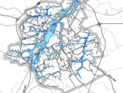
Flood hazard 2019
Brussels-Capital Region : This flood hazard map identifies areas where flooding could occur due to stream overflow, runoff from rainwater, overflowing sewers or a temporary rise in the water table, even in places where no flooding has been observed until now. The absence of a flood hazard zone on the map does not guarantee that flooding will never occur as it does not take into account certain causes of flooding such as a local failure of the sewage network, etc. Please note that these maps have no regulatory value, they have been produced in accordance with the European Directive 2007/60/EC to determine the prevention and protection measures. The maximum scale is 1/10.000 as the modelled data are not representative on a larger scale.
Simple
- Date (Publication)
- 2020-03-22
- Date (Revision)
- 2020-03-22
- Date (Creation)
- 2020-03-22
- Identifier
- Bruxelles Environnement / Leefmilieu Brussel / BRU_ENVI_2f75f24b-961a-45f1-a2ca-0eed6b55d812
- Maintenance and update frequency
- As needed
- GeoBru Administrative Regions
-
- Belgium
- Région de Bruxelles-Capitale
- Spatial scope
-
- Regional
- Access constraints
- Other restrictions
- Other constraints
- No limitations to public access
- Use constraints
- Other restrictions
- Other constraints
- Creative Commons Attribution (CC-BY) - required citation of data source. The full license is available here: https://creativecommons.org/licenses/by/4.0/legalcode
- Spatial representation type
- Grid
- Denominator
- 10000
- Metadata language
- Français
- Metadata language
- Nederlands; Vlaams
- Topic category
-
- Environment
N
S
E
W
))
- gml32:beginPosition
- 2013-01-01
- gml32:endPosition
- 2013-12-31
- Unique resource identifier
- EPSG:31370
- Distribution format
-
-
GML
()
-
GML
()
- OnLine resource
- Flood hazard mapping for the Brussels Region ( WWW:LINK-1.0-http--link )
- OnLine resource
- OnLine resource
- OnLine resource
- https://ows.environnement.brussels/water/wfs3/api? ( OGC API-Features )
- Hierarchy level
- Dataset
Conformance result
- Date (Publication)
- 2010-12-08
- Explanation
- The dataset does not fullfill the minimal requirements
- Pass
- No
- Statement
- Bruxelles Environnement / Leefmilieu Brussel
- File identifier
- 2f75f24b-961a-45f1-a2ca-0eed6b55d812 XML
- Metadata language
- Français
- Character set
- MD_CharacterSetCode_utf8
- Hierarchy level
- Dataset
- Date stamp
- 2026-05-05T12:35:22
- Metadata standard name
- ISO19115
- Metadata standard version
- 2003/Cor.1:2006
Overviews
thumbnail

large_thumbnail
Spatial extent
N
S
E
W
Provided by

Associated resources
Not available