UrbIS - Topo
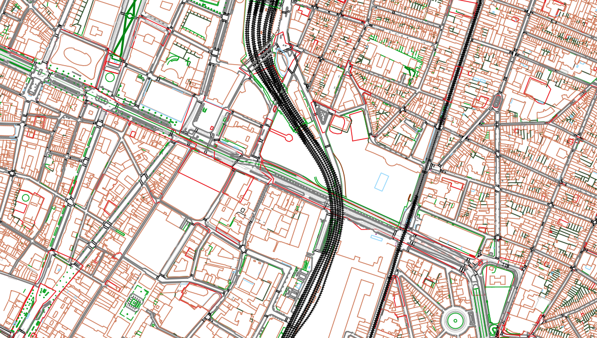
The UrbIS - Topo product is a catalogue of topographic geospatial vector data that contains geometric data, mainly lines, symbols and text. The product offers a digital representation of reality on a large scale through layers grouped by themes (e.g., buildings, roads, green spaces, etc.) and which can contain up to several tens of thousands of elements.
The dataset is freely downloadable as a zipped file.
Simple
- Date (Creation)
- 2012-01-01
- Date (Revision)
- 2025-06-08
- Identifier
- CIRB-CIBG / 10df9c70-6a63-11ed-bb9b-010101010000
- Status
- Completed
- Maintenance and update frequency
- Continual
- Access constraints
- Other restrictions
- Other constraints
- No limitations to public access
- Use constraints
- Other restrictions
- Spatial representation type
- Vector
- Denominator
- 250
- Metadata language
- English
- Metadata language
- Nederlands; Vlaams
- Metadata language
- Français
- Character set
- UTF8
- Topic category
-
- Boundaries
- Description
- Brussels-Capital Region
N
S
E
W
))
- Unique resource identifier
- EPSG:31370
- Distribution format
-
-
Esri Shapefile
(
10.2
)
-
Autocad DWG
()
-
GeoPackage
()
-
Esri Shapefile
(
10.2
)
- OnLine resource
- https://geoservices-urbis.irisnet.be/geoserver/urbistopo/ows?request=GetCapabilities&service=WMS&version=1.3.0 ( OGC:WMS )
- OnLine resource
- https://geoservices-urbis.irisnet.be/geoserver/urbistopo/wfs?request=GetCapabilities&service=WFS&version=2.0.0 ( OGC:WFS )
- OnLine resource
- https://urbisdownload.datastore.brussels/atomfeed/10ded91e-6a63-11ed-9d77-010101010000-en.xml ( ATOM )
- OnLine resource
- Latest version available (gpkg) ( WWW:DOWNLOAD-1.0-http--download )
- OnLine resource
- Latest version available (shp) ( WWW:DOWNLOAD-1.0-http--download )
- OnLine resource
- Styles (sld) of the product ( WWW:DOWNLOAD-1.0-http--download )
- Hierarchy level
- Dataset
Conformance result
- Pass
- Yes
- Statement
- This dataset is produced by integrating data from cyclic photogrammetry and topographic surveys.
- File identifier
- 10ded91e-6a63-11ed-9d77-010101010000 XML
- Metadata language
- English
- Character set
- UTF8
- Hierarchy level
- Dataset
- Date stamp
- 2025-02-12T10:37:55
- Metadata standard name
- Brussels INSPIRE metadata profil
Overviews

Spatial extent
N
S
E
W
))
Provided by

Associated resources
Not available
 Geobru catalogue