INSPIRE - Digital Terrain Model
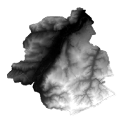
The Digital Terrain Model (DTM) describes the three-dimensional shape of the surface of the Earth (topography of the surface).
The Digital Terrain Model (DTM) is available in three different representations:
- Elevation - vector elements;
- Elevation - Grid;
- Elevation - TIN.
Simple
- Date (Creation)
- 2012-03-30T17:00:00
- Date (Publication)
- 2012-12-21T17:00:00
- Identifier
- BE.CIRB / BRU_URBIS_DTM
- Maintenance and update frequency
- Not planned
- GEMET - INSPIRE themes, version 1.0
-
- Elevation
- GeoBru Administrative Regions
-
- Belgium
- Région de Bruxelles-Capitale
- GeoBru brussels keywords
-
- Reporting Inspire
- Spatial scope
-
- Regional
- Access constraints
- Other restrictions
- Other constraints
- No limitations to public access
- Use constraints
- Other restrictions
- Other constraints
- Creative Commons Attribution (CC-BY) - required citation of data source. The full license is available here: https://creativecommons.org/licenses/by/4.0/legalcode
- Spatial representation type
- Grid
- Distance
- 0.1 http://standards.iso.org/ittf/PubliclyAvailableStandards/ISO_19139_Schemas/resources/uom/gmxUom.xml#m
- Metadata language
- Français
- Topic category
-
- Boundaries
- Imagery base maps earth cover
N
S
E
W
))
- Unique resource identifier
- EPSG:3035
- Geometric object type
- Complex
- Geometric object count
- 150000
- Distribution format
-
-
GML
()
-
GML
()
- OnLine resource
- UrbDTM_GridCoverage.GRID_2012_3m.zip ( WWW:DOWNLOAD-1.0-http--download )
- OnLine resource
- DTM ( OGC:WMS-1.3.0-http-get-capabilities )
- OnLine resource
- https://urbisdownload.datastore.brussels/INSPIRE/URBIS_DTM_GRID_2012.zip ( WWW:DOWNLOAD-1.0-http--download )
- Hierarchy level
- Dataset
Conformance result
- Date (Publication)
- 2010-12-08
- Explanation
- The dataset does fullfill the minimal requirements
- Pass
- Yes
- Statement
- Vol LiDAR 2012
- File identifier
- e8a618a5-68dc-4a7b-9249-bde46f11c5c2 XML
- Metadata language
- Français
- Hierarchy level
- Dataset
- Date stamp
- 2025-03-15T07:12:50
Overviews

thumbnail
Spatial extent
N
S
E
W
))
Provided by

Associated resources
Not available
 Geobru catalogue