 Geobru catalogue
Cartes géotechniques de Bruxelles
Geotechnische kaarten van Brussel (vector, raster)
Geotechnical maps of Brussels (vector, raster)
Simple
-
Datum (publicatie)Date (Publication)Date (Publication)
- 2021-02-26
-
Datum (revisie)Date (Revision)Date (Révision)
- 2021-02-26
-
Datum (creatie)Date (Creation)Date (Création)
- 2021-02-26
-
IdentifierIdentifierIdentificateur
- BE.BELB / BRU_ENVI_67dfc839-3289-46bf-a3f2-dd03bfeb053e
-
StatusStatusEtat
-
compleetCompletedFinalisé
-
HerzieningsfrequentieMaintenance and update frequencyFréquence de mise à jour
-
niet geplandNot plannedNon planifiée
-
GeoBru Administrative Regions
-
-
BelgiqueBelgiëBelgium
-
Région de Bruxelles-CapitaleBrussels Hoofdstedelijk GewestRégion de Bruxelles-Capitale
-
-
Thèmes GEMETGEMET Thema'sGEMET Themes
-
-
environnementmilieuenvironment
-
eaux souterrainesgrondwatergroundwater
-
géologiegeologiegeology
-
hydrogéologiehydrogeologiehydrogeology
-
solbodemsoil
-
sous-solondergrondsubsoil
-
géophysiquegeofysicageophysics
-
hydrographiehydrografiehydrography
-
sciences de la terreaardwetenschappenearth science
-
forageborendrilling
-
base de donnéesgegevensbankdata base
-
-
(Juridische) toegangsrestrictieAccess constraintsContraintes d'accès
-
andersOther restrictionsAutres restrictions
-
Autres contraintesOverige beperkingenOther constraints
-
Pas de restriction concernant l'accès publicGeen beperkingen op openbare toegangNo limitations to public access
-
(Juridische) gebruiksbeperkingUse constraintsContraintes d'utilisation
-
andersOther restrictionsAutres restrictions
-
Ruimtelijk schemaSpatial representation typeType de représentation spatiale
-
vectorVectorVecteur
-
ToepassingsschaalDenominatorDénominateur de l'échelle
- 5000
-
TaalMetadata languageLangue
- Français
-
OnderwerpTopic categoryCatégorie ISO
-
-
Geo wetenschappelijke dataGeoscientific informationInformations géoscientifiques
-
))
- gml32:beginPosition
- 1971-01-01
- gml32:endPosition
- 1990-12-31
-
CodeCodeUnique resource identifier
-
EPSG:31370EPSG:31370EPSG:31370
-
Distributie formaatDistribution formatFormat (encodage)
-
-
ZIPZIPZIP( 1 )
-
-
OnLine bronnenOnLine resourceRessource en ligne
-
Cartes géotechniques 'vecteur' géoréférencées Georeferenceerde 'vector' geotechnische kaarten Georeferenced 'vector' geotechnical maps
(
WWW:DOWNLOAD-1.0-http--download
)
Lien de téléchargement du jeu de données vectorielDownloadlink van de vector datasetDownload link for the vector dataset
-
OnLine bronnenOnLine resourceRessource en ligne
-
Cartes géotechniques 'raster' géoréférencées Georeferenceerde 'raster' geotechnische kaarten Georeferenced 'raster' geotechnical maps
(
WWW:DOWNLOAD-1.0-http--download
)
Lien de téléchargement du jeu de données rasterDownloadlink van de raster datasetDownload link for the raster dataset
-
OnLine bronnenOnLine resourceRessource en ligne
-
Cartes numérisées et notices explicatives FR/NL associées .pdf Genummerde kaarten en bijhorende toelichting FR/NL .pdf Digitized maps and associated FR/NL explanatory notes .pdf
(
WWW:DOWNLOAD-1.0-http--download
)
Lien de téléchargement pdfDownloadlink pdfDownload link pdf
-
Niveau kwaliteitsbeschrijvingHierarchy levelNiveau
-
datasetDatasetJeu de données
Resultaat conformiteit met de specificatie
Conformance result
Résultat de conformité
-
Datum (publicatie)Date (Publication)Date (Publication)
- 2010-12-08
-
ExplicationUitlegExplanation
-
Le jeu de données ne répond pas aux exigences minimales prédécritesDe dataset volgt niet de minimale vereissenThe dataset does not fullfill the minimal requirements
-
Indicatie van conformiteit met de specificatiePassDegré de conformité
- No
-
Généralités sur la provenanceAlgemene beschrijving herkomstStatement
-
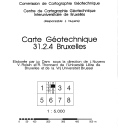
Les cartes géotechniques de Bruxelles ont été élaborées par J.P. Dam, sous la direction du Prof. J. Nuyens, V. Roisin et R. Thonnard de l’Université Libre de Bruxelles (ULB) et de la Vrije Universiteit Brussel (VUB), membres du Centre de Cartographie Géotechnique Interuniversitaire dirigé par J. Nuyens (ULB). Elles ont ensuite été éditées à l’échelle 1/5000 entre 1976 et 1990 par l’Institut Géotechnique de l’Etat.De geotechnische kaarten van Brussel werden uitgewerkt door J.P. Dam, onder leiding van prof. J. Nuyens, V. Roisin en R. Thonnard van de Université Libre de Bruxelles (ULB) en de Vrije Universiteit Brussel (VUB), leden van het eden van het Brussels Interuniversitair Centrum voor Grondmechanische Kartering dat wordt geleid door J. Nuyens (ULB). Ze werden vervolgens tussen 1976 en 1990 op een schaal van 1/5000 uitgegeven door het Rijksinstituut voor Grondmechanica.The geotechnical maps of Brussels were elaborated by J.P. Dam, under the direction of prof. J. Nuyens, V. Roisin and R. Thonnard of the Université Libre de Bruxelles (ULB) and of the Vrije Universiteit Brussel (VUB), members of the Centre Interuniversitaire pour la Cartographie Géotechnique directed by J. Nuyens (ULB). They were then published at a scale of 1/5000 between 1976 and 1990 by the ‘Institut Géotechnique de l’Etat’ (State Geotechnical Institute).
-
Metadata IDFile identifierIdentifiant de la fiche
- 67dfc839-3289-46bf-a3f2-dd03bfeb053e XML
-
TaalMetadata languageLangue
- Français
-
KaraktersetCharacter setJeu de caractères
-
MD_CharacterSetCode_utf8MD_CharacterSetCode_utf8MD_CharacterSetCode_utf8
-
Hierarchisch niveauHierarchy levelType de ressource
-
datasetDatasetJeu de données
-
Metadata datumDate stampDate des métadonnées
- 2025-12-09T17:24:07
- Metadata standard name
- ISO19115
- Metadata standard version
- 2003/Cor.1:2006
Overviews
Spatial extent
Provided by
