 Geobru catalogue
Built density
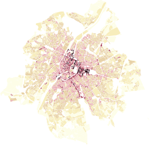
This dataset represents the built density of urban blocks within the territory of the Brussels-Capital Region. It provides four indicators: the floor space index (FSI), the ground space index (GSI), the average number of storeys, and the maximum building height.
Simple
- Date (Creation)
- 2026-07-06
- Date (Revision)
- 2026-07-06
- Identifier
- BE.BRUSSELS.PERSPECTIVE / 27691cb2-7945-11f1-b1be-b07d64b384b7
- Status
- Completed
- Maintenance and update frequency
- Irregular
- Access constraints
- Other restrictions
- Other constraints
- public access limited according because of existing intellectual rights
- Use constraints
- Other restrictions
- Other constraints
- Creative Commons Attribution (CC-BY) - required citation of data source. The full license is available here: https://creativecommons.org/licenses/by/4.0/legalcode
- Spatial representation type
- Vector
- Denominator
- 1000
- Metadata language
- English
- Metadata language
- Nederlands; Vlaams
- Metadata language
- Français
- Character set
- UTF8
- Topic category
-
- Planning cadastre
- Description
- Brussels-Capital Region
N
S
E
W
))
- Unique resource identifier
- EPSG:31370
- Codespace
- EPSG
- Distribution format
-
-
Esri Shapefile
(
10.2
)
-
GeoJSON
()
-
GeoPackage
()
-
GML
(
3.2.1
)
-
Esri Shapefile
(
10.2
)
- OnLine resource
- https://gis.urban.brussels/geoserver/PERSPECTIVE/wms?service=WMS&version=1.3.0&request=GetCapabilities ( OGC Web Map Service )
- OnLine resource
- https://gis.urban.brussels/geoserver/PERSPECTIVE/wfs?service=WFS&version=2.0.0&request=GetCapabilities ( OGC Web Feature Service )
- OnLine resource
- Built density (shapefile format) ( WWW:DOWNLOAD-1.0-http--download )
- OnLine resource
- Built density (geopackage format) ( WWW:DOWNLOAD-1.0-http--download )
- OnLine resource
- Built density (json format) ( WWW:DOWNLOAD-1.0-http--download )
- OnLine resource
- Built density (gml format) ( WWW:DOWNLOAD-1.0-http--download )
- Hierarchy level
- Dataset
Conformance result
- Date (Publication)
- 2026-04-01
- Pass
- Yes
- Statement
- The dataset was produced by combining multiple data sources, including field surveys from perspective.brussels used to determine the number of building levels, 2D building data from UrbIS – Parcels and Buildings (paradigm.brussels), and the UrbIS – 3D Buildings product (paradigm.brussels). These sources were integrated to obtain an accurate understanding of building geometry, including floor area, building footprint, number of levels, and maximum height, used for the calculation of built density indicators.
- File identifier
- 276835e4-7945-11f1-a14e-b07d64b384b7 XML
- Metadata language
- English
- Character set
- UTF8
- Hierarchy level
- Dataset
- Date stamp
- 2026-07-23T12:59:05
- Metadata standard name
- Brussels INSPIRE metadata profil
Overviews
Spatial extent
N
S
E
W
Provided by

Associated resources
Not available