 Geobru catalogue
Open rivers bed
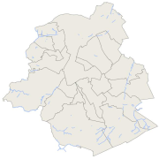
Brussels-Capital Region : Location of open rivers bed in the Brussels region. Includes additional information : the name and type (channel, ditch, ...) of hydrological segment.
Simple
- Date (Creation)
- 2007-01-01
- Date (Revision)
- 2013-07-23
- Date (Publication)
- 2013-07-23
- Identifier
- Bruxelles Environnement / Leefmilieu Brussel / BRU_ENVI_WATER_RIVER_OPEN
- Maintenance and update frequency
- As needed
- GeoBru Administrative Regions
-
- Belgium
- Région de Bruxelles-Capitale
- GeoBru brussels keywords
-
- Blue Network
- Bruenvi
- Access constraints
- Other restrictions
- Other constraints
- No limitations to public access
- Use constraints
- Other restrictions
- Other constraints
- Creative Commons Attribution (CC-BY) - required citation of data source. The full license is available here: https://creativecommons.org/licenses/by/4.0/legalcode
- Denominator
- 500
- Metadata language
- fre
- Metadata language
- Nederlands; Vlaams
- Topic category
-
- Inland waters
N
S
E
W
))
- gml32:beginPosition
- 2007-01-01
- gml32:endPosition
- 2021-01-01
- Unique resource identifier
- EPSG:31370
- Geometric object type
- Curve
- Distribution format
-
-
GML
()
-
GML
()
- OnLine resource
- Service de téléchargement (WFS) des données de Bruxelles Environnement ( OGC:WFS )
- OnLine resource
- Service de visualisation (WMS) des données de Bruxelles Environnement ( OGC:WMS )
- Hierarchy level
- Dataset
Conformance result
- Date (Publication)
- 2010-12-08
- Explanation
- The dataset does not fullfill the minimal requirements
- Pass
- No
- Statement
- Bruxelles Environnement / Leefmilieu Brussel
- File identifier
- 65d758d2-1a0f-4f04-93a6-8ab606d01b0f XML
- Metadata language
- Français
- Hierarchy level
- Dataset
- Date stamp
- 2024-03-08T12:54:29
Overviews
thumbnail

large_thumbnail
Spatial extent
N
S
E
W
Provided by

Associated resources
Not available